🎧 Audio Companion · Day 2

Ridgway & Orvis Hot Springs

Scroll along as you listen — photos and info cards match the audio order.
Colorado Hot Springs Road Trip · May 2026 · Elevation: 6,985 ft
DAY 2 · RIDGWAY
🎧 Ridgway — The San Juan Volcanic Field & Orvis Hot Springs

⬇️ Download episode MP3 (83 min · 77MB)
🎧 EXTENDED PODCAST
Ridgway + Ouray Deep Dive — 3 hrs · 84MB
0:00 --:--
Speed:
🚗 Chapter 1: The Drive — Crystal River Valley to McClure Pass
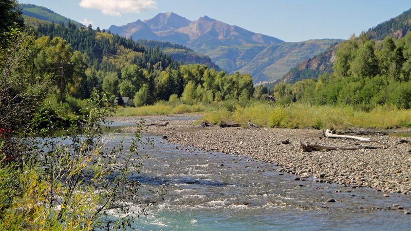
Crystal River at Redstone, Colorado
Wikimedia / Dave Dugdale (CC BY-SA 2.0)
Crystal River Valley and Redstone

The Route
From Glenwood Springs, Highway 133 follows the Crystal River south through one of Colorado's most underrated valleys. The Crystal flows clear and fast through a narrow corridor between canyon walls before opening into meadows at Carbondale. Redstone, a tiny Victorian coal camp, sits 17 miles up the valley, its 1902 coke ovens still standing along the riverbank like a row of stone beehives.
What you're driving through
The Crystal River valley sits at the transition zone between the Colorado Plateau to the west and the Rocky Mountain uplift to the east. The rock changes character visibly: red Mesaverde sandstone giving way to dark Cretaceous marine shales, then Paleocene continental deposits as you climb. McClure Pass (8,755 ft) marks the drainage divide. Water to the north drains to the Colorado River; water to the south drains through the Gunnison basin.
The 1923 Connection
In 1923, the Crystal River valley was still horse-and-wagon country for most supply traffic. The automobile was just beginning to displace the pack mule on Colorado's mountain roads, and this valley was exactly the kind of through-route where that transition was visible: a loaded wagon sharing the road with a Ford Model T.
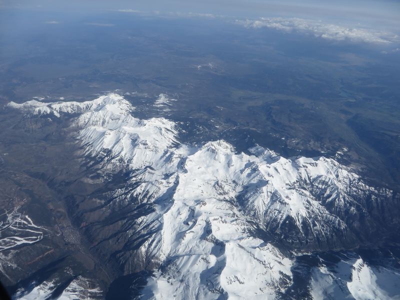
San Juan Mountains panorama, Colorado
Wikimedia / Mitchtobin (CC BY-SA 4.0)
First View: The San Juan Mountains

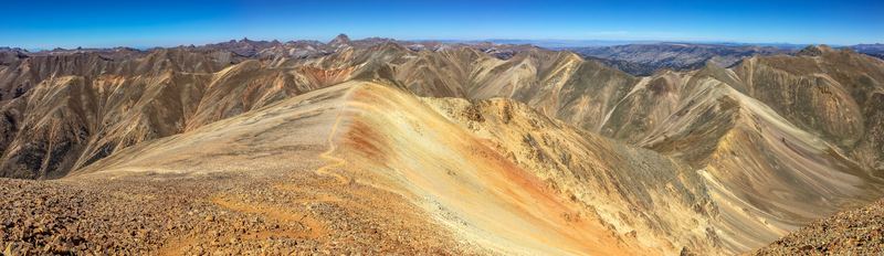
As you crest McClure Pass and begin the descent toward Paonia and then south toward Ridgway, the San Juans come into view as a wall of peaks to the south. These aren't ordinary mountains. They're built from the largest concentration of volcanic material in North America, stacked on top of an older Rocky Mountain backbone. The jagged, deeply colored profile that distinguishes them from the Sawatch Range to the east is a product of volcanic rock being more resistant to glacial carving in some directions and more susceptible in others, creating dramatic fins, cirques, and knife-edged ridges.
Scale
The San Juan Volcanic Field covers approximately 25,000 square kilometers of southwestern Colorado. It produced an estimated 10,000 cubic kilometers of volcanic material over roughly 10 million years (35 to 25 million years ago). The entire region is underlain by an enormous reservoir of magmatic heat that hasn't fully dissipated, which is why Orvis Hot Springs still flows at 127°F today.
🌋 Chapter 2: The San Juan Volcanic Field — Built by Fire
San Juan caldera and volcanic geology
Wikimedia / Peter W. Lipman, USGS (Public domain)
The Caldera System — Supervolcanoes of the San Juans

What happened here
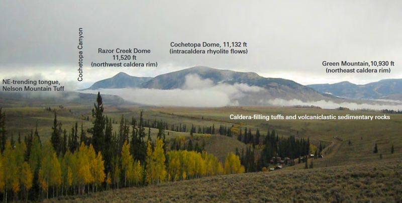
Between 35 and 25 million years ago, at least 18 separate calderas erupted in the San Juan region. A caldera isn't a volcano in the conventional sense. It's what's left after a volcano erupts so much material so fast that the magma chamber empties and the overlying rock collapses inward. The result is a massive depression, often 10 to 40 miles across, that fills with subsequent eruptions, lakes, and sediment.
La Garita — The Biggest Eruption in Earth's History
The La Garita Caldera, centered near Creede, produced the Fish Canyon Tuff eruption approximately 28 million years ago. Volume: approximately 5,000 cubic kilometers of ash and lava. That's 1,000 times larger than the 1980 Mount St. Helens eruption. The Fish Canyon Tuff is the largest known single eruptive event in Earth's geological record. You drive across it repeatedly in southwestern Colorado without realizing it. The broad, flat mesas with their distinctive orange-pink cliffs are cooling sheets from this single eruption.
The Silverton Caldera
Closer to Ridgway, the Silverton Caldera complex was the focus of several eruption cycles between 28 and 26 million years ago. The mineralization that created the gold and silver deposits mined at Silverton, Ouray, and the Camp Bird Mine is directly tied to hydrothermal fluids that circulated through the caldera system as it cooled. Billion-dollar mining wealth, created by supervolcanic geology.
Uncompahgre Wilderness canyon walls and river
Wikimedia / Bureau of Land Management (Public domain)
The Uncompahgre Plateau — Ancient Basement Exposed

What it is
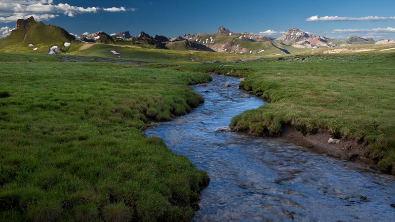
The broad mesa that dominates the western skyline as you approach Ridgway is the Uncompahgre Plateau, an uplifted block of ancient Precambrian basement rock. While the San Juan Mountains to the east are volcanic and relatively young, the Uncompahgre Plateau is ancient. Its basement rocks date to 1.7 billion years ago, the same Precambrian material visible in the depths of Glenwood Canyon.
The Red Beds
The distinctive red-orange slopes visible around Ridgway and along the Uncompahgre River are the Cutler Formation, Permian-age (280 million years) sediment eroded from an earlier mountain range called the Ancestral Rockies. These ancient mountains rose and eroded long before the modern Rockies existed. The red color comes from iron oxide in the sand, the same chemistry that colors the canyon walls of the Colorado Plateau to the west. Ridgway sits at the geological boundary where the plateau's red beds meet the volcanic San Juan terrain.
♨️ Chapter 3: Orvis Hot Springs
Orvis Hot Springs — The Crater at 127°F

Source
The spring water at Orvis emerges from the source called "the Crater" at 127°F. This is a gravity-fed system, which means no pumping or mechanical heating. The water flows from underground entirely by hydrostatic pressure. The Crater is a natural opening in the earth where the geothermal water surfaces.
Temperature
🌡️ 97°F – 108°F across 10 soaking areas
The lithium connection
Orvis water is notably lithium-rich, higher concentrations than most Colorado hot springs. Lithium at low doses has been associated with mood stabilization in medical research, which is part of what makes the soaking experience at Orvis feel different from other pools. The San Juan volcanic geology is responsible: lithium concentrates in late-stage magmatic fluids that crystallize into pegmatite dikes, and the hydrothermal circulation that feeds Orvis passes through lithium-bearing formations as it rises.
10 soaking areas
  • The Crater: the hottest pool, closest to the source, 106°F+
  • Indoor communal pool: 103°F, good for extended soaking
  • Outdoor tubs, cold plunge pond, and clothing-optional areas
  • The "lobster pot": the hottest outdoor pool, for the experienced soaker
Why here specifically
The spring emerges at this location because the Uncompahgre fault zone provides the fracture plumbing that allows deeply heated water to ascend. The same fault system that created the Uncompahgre Valley also created the geothermal plumbing. Ridgway sits at the intersection of the plateau fault system and the volcanic San Juan terrain, which is ideal geology for hot spring formation.
🏛️ Chapter 4: The Tabeguache (Uncompahgre) Ute People
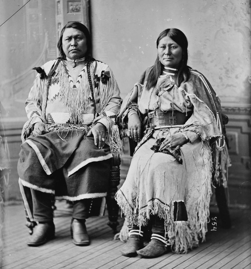
Chief Ouray, Ute leader, Brady-Handy portrait
Wikimedia / Brady-Handy Photograph Collection, Library of Congress (Public domain)
Millennia before 1881
Chief Ouray and the Tabeguache Ute

The Tabeguache band of the Ute people (also called the Uncompahgre Ute) had lived in this region for centuries. Their territory encompassed the Uncompahgre Valley, the San Juan Mountains, and the high plateaus on either side. The town of Ouray is named after their most prominent chief, a title that carries layers of bitter irony. The man who negotiated longest to keep Ute land eventually lost it all, and the town that displaced his people bears his name.
Chief Ouray (1833-1880) was a remarkable negotiator who spoke English, Spanish, and several Ute and Pueblo languages. He understood treaty law better than most of the government agents he dealt with. He negotiated the Brunot Agreement of 1873, ceding the San Juan Mountains (the mineral-rich area the government desperately wanted) in exchange for guaranteed Ute sovereignty over the western slope. The government immediately violated the terms. He spent the last years of his life in Washington, DC, fighting the broken promises through legal channels. He died in 1880, one year before his people were force-marched out of Colorado.
The removal of 1881
The Meeker Massacre of September 1879 gave political cover for what politicians had wanted for years: the complete removal of the Ute from Colorado. Indian Agent Nathan Meeker had ordered the plowing of the Ute horse pasture at the White River Agency, deliberately destroying their horses' grazing as part of a campaign to force them into farming. The Ute response killed Meeker and 10 agency employees. The public outrage ("The Utes Must Go") was immediate. In August 1881, the Army force-marched approximately 1,500 Uncompahgre Ute 225 miles across the desert to a Utah reservation. Ridgway, Ouray, and the Uncompahgre Valley were incorporated and subdivided within years of their removal.
⛏ Chapter 5: Mining History — Camp Bird Mine and Thomas Walsh
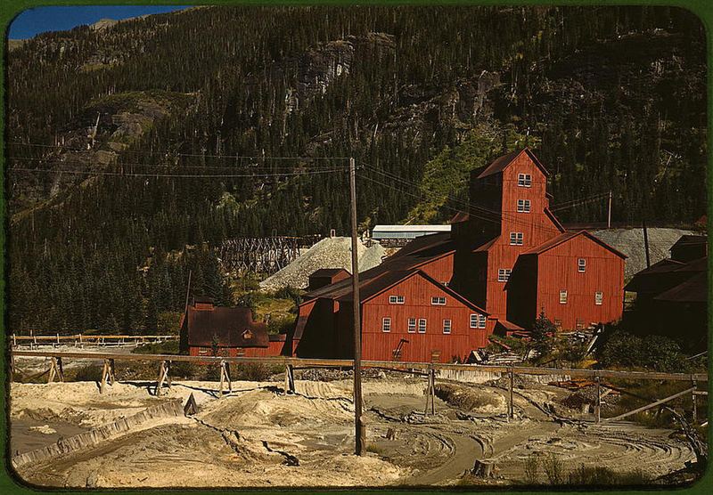
Camp Bird Mine mill, Ouray County, Colorado, 1940
Wikimedia / Russell Lee, Library of Congress (Public domain)
1896 discovery
Camp Bird Mine — The Hope Diamond Connection

In 1896, Thomas Walsh, an Irish immigrant who had already struck and lost fortunes in mining, bought a collection of claims above Ouray for a modest sum. Other miners had given up on the area. Walsh noticed something they had missed: the gold wasn't in the standard ore veins but in the altered country rock around them, a zone of secondary enrichment that the established miners had dismissed as waste rock. He was right. The Camp Bird Mine became one of the richest gold mines in the world.
The Numbers
Between 1896 and 1902, Walsh extracted approximately $3.5 million in gold per year in 1890s dollars. Total production over the mine's life exceeded $27 million. Walsh sold his controlling interest in 1902 for $3.5 million cash plus stock. He used the proceeds to build Walsh Mansion in Washington, DC, one of the largest private homes in the city, and to launch his family into Gilded Age society.
Evalyn Walsh and the Hope Diamond
Walsh's daughter Evalyn became one of the most famous socialites of the early 20th century. In 1911, she purchased the Hope Diamond from Pierre Cartier for $154,000. After her death, her estate sold it to jeweler Harry Winston, who donated it to the Smithsonian Institution in 1958, where it remains today. The 45.52-carat blue diamond in the Natural History Museum's gem hall is a direct descendant of Camp Bird gold.
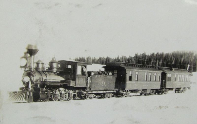
Rio Grande Southern Railroad historic locomotive
Wikimedia / Unknown photographer (Public domain)
1891 – 1952
The Rio Grande Southern Railroad

The Rio Grande Southern was the railroad of the San Juan Mountains: 172 miles of narrow-gauge track connecting Ridgway to Durango via Telluride, Rico, and Dolores. It opened in 1891 and immediately became the lifeline of the mining camps. Ore came down from Telluride, Silverton, and the high camps on flatcars. Supplies went up: food, timber, machinery, coal, blasting powder.
The 1923 Connection
In 1923, the Rio Grande Southern was in its middle years, hauling ore and livestock as the mining boom faded but before the automobile fully replaced rail for freight. Pack mule supply trains still ran from the RGS depots up to high-altitude mines that no road reached. The transition from mule to motorized transport was visible in real time at the Ridgway depot, where the horse economy met the steam economy.
The Galloping Geese
By the 1930s, the railroad was losing money rapidly to highways. To cut costs, they converted Pierce-Arrow automobiles and other vehicles into motorized rail cars called "Galloping Geese," the front half of a truck or car grafted onto a flatcar chassis. They became famous; several are preserved at the Colorado Railroad Museum in Golden. The railroad finally closed in 1952, the tracks were pulled up, and the right-of-way became the highway you're driving.
True Grit — Ridgway and Ouray on Film

The 1969 film True Grit, starring John Wayne in his Oscar-winning role as Marshal Rooster Cogburn, was filmed primarily in the Ridgway and Ouray area. The town's Victorian commercial buildings, the surrounding terrain, and the dramatic canyon scenery provided the authentic 19th-century Western atmosphere the production needed. Several scenes were shot on local ranches that are still operating today.
Ridgway was also a filming location for How the West Was Won (1962) and City Slickers (1991). Production companies chose this area repeatedly because it looks like what people imagine the Old West looked like, and because the terrain and architecture are the real thing rather than constructed sets.
🏔 Chapter 6: Dallas Divide and the Mt. Sneffels View
Mount Sneffels from Dallas Divide, San Juan Mountains, Colorado
Wikimedia / Ken Lund (CC BY-SA 2.0)
Dallas Divide — One of Colorado's Most Photographed Views

The View
Dallas Divide (8,970 ft), on Highway 62 between Ridgway and Placerville, offers a view of the Mt. Sneffels massif and the Sneffels Range that has become one of the most reproduced landscape photographs in Colorado. In autumn, aspen meadows in the foreground turn gold against the gray granite peaks. In late May, the high snowfields are still bright white while the lower slopes show first green.
Mt. Sneffels
Mt. Sneffels (14,150 ft) is one of Colorado's 58 fourteeners and the highest point of the Sneffels Range. The name comes from a Jules Verne novel, "Journey to the Center of the Earth" (1864), which features Snaefellsjokull in Iceland. Early map-makers working in the area were apparently reading Verne. The peak is volcanic in origin, part of the same caldera system that built the San Juans, but older than the main volcanic field and carved by glaciation into the classic alpine peak profile.
Geology visible from Dallas Divide
The steeply dipping layers visible on the flanks of Sneffels are a visible record of intrusive activity associated with caldera formation: ring dikes, volcanic breccia, and intruded sills that were tilted by the collapse and resurgence of the caldera system. What looks like textbook mountain geology is actually the frozen snapshot of a supervolcanic system caught in the act of collapsing inward, 28 million years ago.
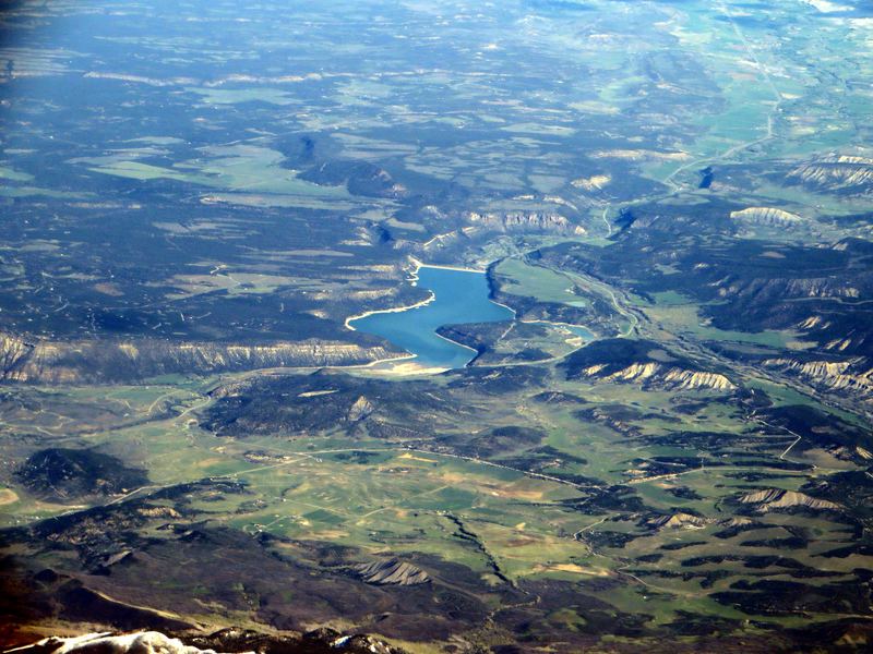
Ridgway Reservoir with San Juan Mountain reflection
Wikimedia / Ken Lund (CC BY-SA 2.0)
Ridgway Reservoir — San Juan Mountain Reflection

Ridgway Reservoir is a 1,000-acre impoundment on the Uncompahgre River, created by Ridgway Dam in 1987. At 6,900 feet elevation with the San Juan Mountains rising to the south, it offers one of the more photogenic reservoir views in Colorado. On calm mornings, the Mt. Sneffels massif reflects on the water surface.
Wildlife at the reservoir
  • Osprey nesting: 2 to 4 active nests most years, visible from the boat ramp
  • Great blue herons along the shoreline
  • White pelicans (surprisingly common on Uncompahgre Valley water bodies)
  • Mule deer and pronghorn in the surrounding grasslands at dawn and dusk
  • Prairie dog towns in the drier benches above the waterline
🦅 Chapter 7: Wildlife of the Ridgway Valley
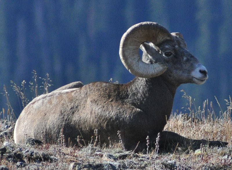
Rocky Mountain Bighorn Sheep on cliff
Wikimedia / dw_ross (CC BY 2.0)
Bighorn Sheep — The Ouray In-Town Herd
Ovis canadensis

Ouray has one of the most accessible bighorn sheep herds in Colorado. The Uncompahgre Gorge that runs through town provides cliff habitat directly adjacent to the streets. It's common to see bighorn on the rock faces visible from downtown sidewalks. The herd has habituated to town to the degree that individuals cross the main bridge and wander into parking areas.
Why they're here
Bighorn sheep require steep terrain for predator escape and mineral licks for sodium supplementation. The Uncompahgre Gorge provides both: sheer rock walls and natural salt seeps in the calcareous rock. The year-round water supply in the river bottom and the thermal advantage of the south-facing canyon walls in winter make this a nearly ideal habitat.
In late May
Ewes are lambing on ledges. Lambs are born at approximately 8 pounds and are walking within hours, following their mothers on terrain that would terrify a human rock climber. Their hooves have a hard outer edge for grip on rock edges and a soft, pliable inner pad for surface adhesion, a biological design no climbing shoe has fully replicated.
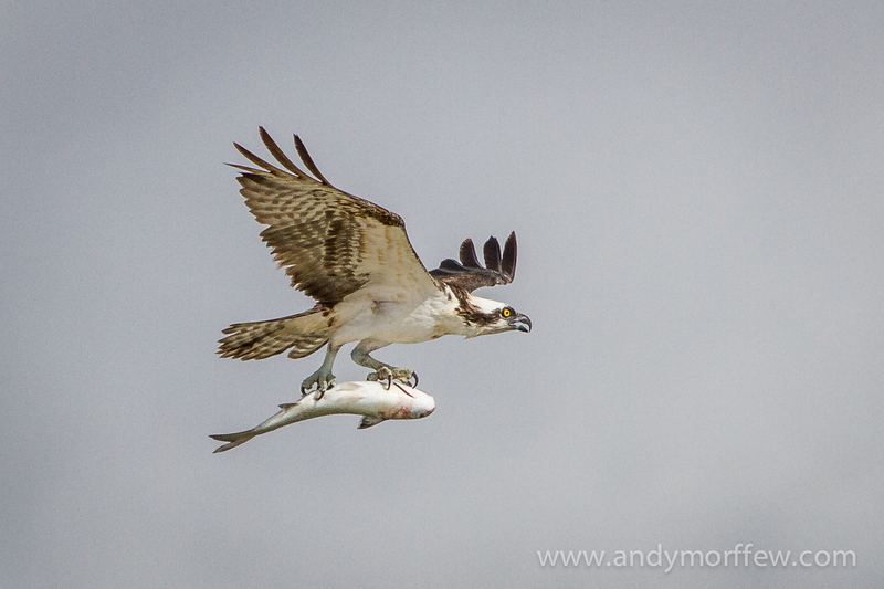
Osprey flying to nest
Wikimedia / Andy Morffew (CC BY 2.0)
Osprey at Ridgway Reservoir
Pandion haliaetus

Where to spot
Ridgway Reservoir (Ridgway State Park, 3 miles north of town) is a reliable osprey site. Look for platform nests on power poles and dead snags around the reservoir perimeter. In May, birds are actively nesting and both adults are frequently visible carrying fish from the reservoir to the nest.
The fishing sequence
Osprey hunt by hovering 30 to 60 feet above the water, then plunging feet-first. Their feet have reversible outer toes (no other raptor can do this) and barbed spiny pads that grip wet fish. They're the only North American raptor that regularly dives completely underwater. Watch for the post-dive behavior: osprey orient the fish head-forward in their feet before flying, reducing aerodynamic drag for the return trip to the nest.
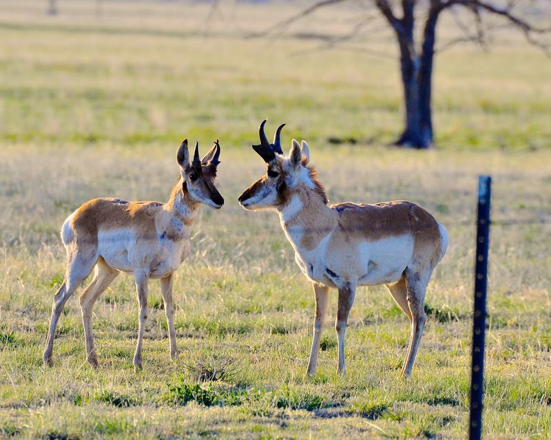
Pronghorn antelope on grassland
Wikimedia / Larry Lamsa (CC BY 2.0)
Pronghorn Antelope — North America's Fastest Land Animal
Antilocapra americana

The grasslands and sagebrush flats between Ridgway and Montrose host a healthy pronghorn population. These aren't true antelopes (which are Old World animals). Pronghorn are the sole living member of an ancient North American family, Antilocapridae, that evolved on this continent alongside American cheetahs and giant wolves. Their incredible speed (top: 55 mph, sustained: 40 mph for miles) is the evolutionary legacy of keeping ahead of predators that are now extinct.
The ghost cheetah
North America had its own cheetah-like predator (Miracinonyx) until 12,000 years ago. The pronghorn's extraordinary speed is over-engineered for the wolves and coyotes that remain. Biologists call this "evolutionary anachronism": the pronghorn is essentially still running from a ghost.
How to spot
Pronghorn flash white rump patches as an alarm signal, a distinctive white fan visible at great distance. They prefer open terrain where they can see for miles. Look for them in the sagebrush flats along US-550 between Ridgway and Montrose, especially in early morning.
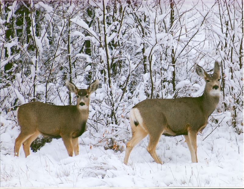
Mule deer in first snow, Colorado
Wikimedia / USFWS Mountain-Prairie (CC BY 2.0)
Mule Deer
Odocoileus hemionus

In the Ridgway area
Mule deer are abundant in the sagebrush and Gambel oak transition zones around Ridgway, particularly along the river bottoms and the lower slopes of the Uncompahgre Plateau. In late May, does are giving birth to spotted fawns in the brush. Fawns found alone are not orphaned. The mother is typically within a few hundred yards, returning to nurse several times daily. The spotted coat breaks up the fawn's outline in dappled light: camouflage, not a sign of distress.
How to identify
Large mule-like ears that swivel independently. Black-tipped tail on a white rump patch. A bounding, stiff-legged gait called "stotting" when alarmed, which covers rough terrain faster than direct pursuit. Bucks are in velvet antlers now, growing at roughly an inch per day.
🌿 Chapter 8: Sagebrush Ecology and High-Desert Plants
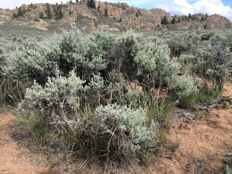
Sagebrush steppe near Gunnison, Colorado
Wikimedia / Matt Lavin (CC BY-SA 2.0)
MEDICINAL
Big Sagebrush
Artemisia tridentata

The silvery-gray shrub that defines the smell of the intermountain West is big sagebrush, the landscape plant of the Ridgway valley floor and the Uncompahgre Plateau benches. When it rains (or when you crush a leaf), the volatile compounds (primarily camphor and terpene oils) released produce that distinctive smell inseparable from the feeling of the West.
Ute uses
The Ute people used sagebrush extensively. The leaves were dried and burned as a smudge for ceremonial purification. Tea from the leaves was used for colds and fevers. The bark was shredded into soft fiber for lining cradle boards and making mats. Bundles of sagebrush provided tinder and kindling. It was among the most versatile plants in the Western Slope Ute toolkit.
Ecology
Mature sagebrush ecosystems support over 170 wildlife species. Sage grouse depend on it exclusively; pronghorn rely on it as winter forage when snow covers grass. Sagebrush is the structural foundation of an entire ecosystem. When it's removed by development, overgrazing, or fire followed by cheatgrass invasion, the associated community collapses. Colorado has lost roughly 50% of its sagebrush habitat over the past century.
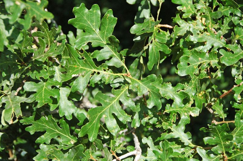
Gambel oak, Black Canyon of the Gunnison National Park
Wikimedia / James St. John (CC BY 2.0)
CAUTION — acorns need processing
Gambel Oak
Quercus gambelii

Where the sagebrush flats meet the canyon slopes and the elevation climbs above 6,500 feet, Gambel oak takes over. In the Ridgway area you see it on the lower flanks of the Uncompahgre Plateau and in the canyon country around Ouray. In late May it's pushing out new leaves, small and bright green, with the deeply lobed outline that distinguishes it from other Colorado shrubs.
Acorns — edible with processing
Acorns ripen in September. Raw, they're intensely bitter from tannins. The Ute processed them by leaching: grinding the acorns into meal, then soaking in multiple changes of cold water for 12 to 48 hours until the bitterness was gone. The resulting flour was made into flat cakes or porridge. Acorn meal is high in fat, protein, and complex carbohydrates, a complete staple food that kept well through winter.
Ecology
Gambel oak can spread clonally through root sprouts. Entire hillsides can be a single genetic individual. After wildfire, the root system resprouts vigorously, often producing a thicker stand than before. Black bears gorge on acorns in fall, adding critical fat reserves before winter denning.
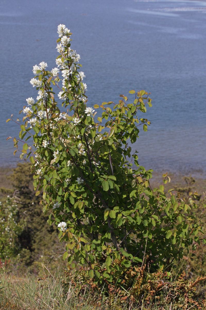
Serviceberry (Amelanchier alnifolia) flowers in bloom
Wikimedia / Walter Siegmund (CC BY-SA 3.0)
EDIBLE
Serviceberry / Saskatoon
Amelanchier alnifolia

In late May, serviceberry is in full bloom on the canyon slopes around Ridgway and Ouray: clouds of small white five-petaled flowers on a multi-stemmed shrub, often filling the air with a faint sweet scent. The berries ripen in July and August to a deep blue-purple.
Edible uses
Serviceberries were among the most important wild fruits for Indigenous peoples throughout the West. The Ute ate them fresh, dried them for winter, and mixed them with meat and fat to make a kind of pemmican that kept for months. The berries taste like blueberries with a hint of almond. Bears, foxes, and birds compete heavily for the crop in summer.
How to identify
  • White five-petaled flowers in dense clusters, blooming before or with leaves in spring
  • Oval leaves with fine teeth along the upper half of the leaf margin only
  • Berries: blue-purple when ripe, about the size of a blueberry, with a crown of persistent sepals at the tip
  • Multi-stemmed shrub, 4 to 12 feet tall, often at forest edges and canyon slopes
⏱️ Chapter 9: The 1923 Connection — Mule to Motorcar
1923 — The Hinge Year in the San Juans

1923 was a specific moment in the transition between the horse-powered West and the motorized West. The mining boom had peaked by 1910; the Rio Grande Southern was losing freight to early automobile roads. Pack mule supply trains still ran from the Ridgway depot to high-altitude mines that no road reached, but the first Model T's were appearing at the same trailheads where mule teams loaded ore.
What was happening in 1923 at Ridgway
  • The RGS railroad still ran daily service through Ridgway to Telluride and Durango, carrying ore and livestock
  • Camp Bird Mine (sold by Walsh in 1902) was still operating under British ownership, producing gold
  • The Uncompahgre Ute had been removed 42 years earlier: just within living memory for some residents
  • Chief Ouray's name was on the town to the south, on the county, and on everything visible
  • The first improved auto road over Red Mountain Pass (between Ouray and Silverton) was under construction
Pack mule supply trains
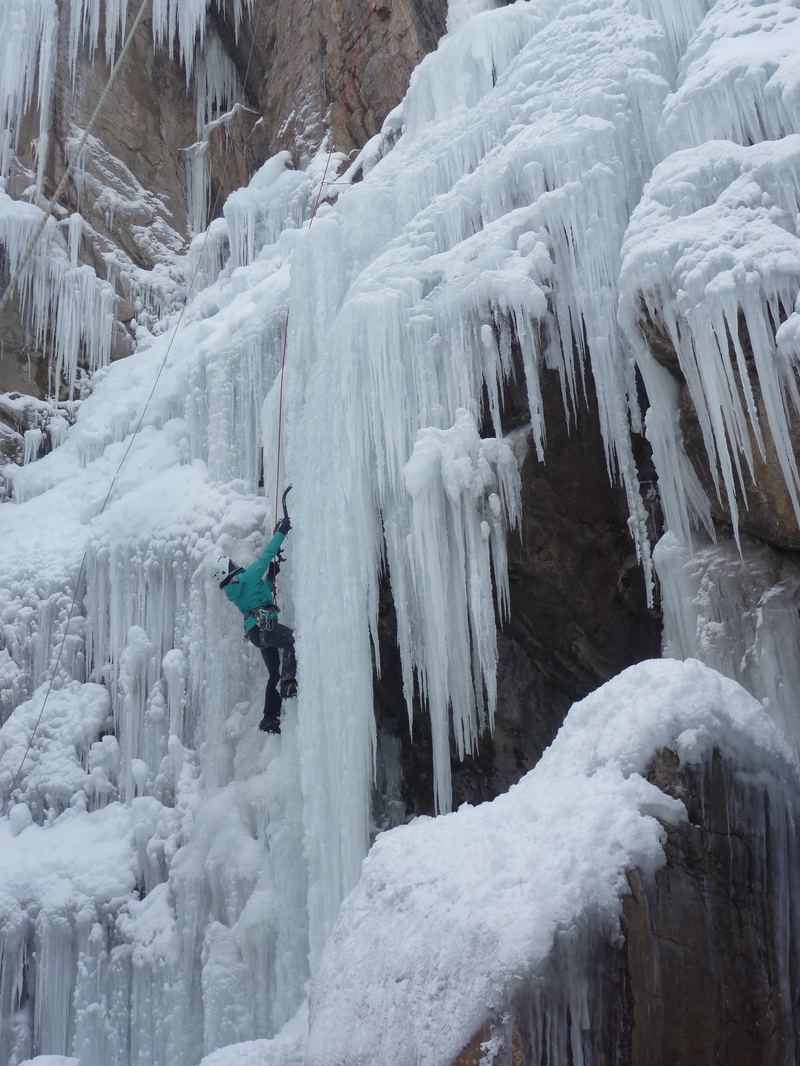
The mines above timberline (11,000 to 13,000 feet) were not reachable by any road in 1923. Everything that went up went by mule: timber for shoring, black powder, food, tools, and machinery in pieces that could be packed. Everything that came down came by mule: ore sacks, equipment, sometimes injured miners. A loaded mule carried 250 to 300 pounds. The muleskinners who ran these trains were specialists in a technology that was, by 1923, already counting its remaining years.
📍 Chapter 10: Come Back for This
Ridgway and Ouray — Worth a Return Trip

🧗 Ouray Via Ferrata
Colorado's most celebrated via ferrata route above the Uncompahgre Gorge. Iron rungs and cables drilled into the canyon walls above the river. No technical climbing experience required, but a helmet and harness are mandatory. Guides available through Ouray Mountain Sports. Best in summer when the canyon is dry.
🥶 Ouray Ice Park
The world's first artificially created public ice climbing park, running since 1994 in the Uncompahgre Gorge. Every winter, the city pipes water from above to create more than 2 miles of ice climbing terrain ranging from beginner to 5.14 difficulty. Open December through March. The Ouray Ice Festival in January is the largest ice climbing gathering in North America.
🏔 Bear Creek Trail (Ouray)
A National Recreation Trail that follows Bear Creek canyon from Ouray into the Sneffels Wilderness. The first section is carved into cliff faces and offers exposed canyon views. The upper section reaches the historic Yellow Jacket Mine. Round trip: 10.5 miles, 2,700 ft elevation gain. Boots required.
🎴 Ridgway Reservoir State Park
Kayaking, paddleboarding, and fishing on a 1,000-acre reservoir with San Juan Mountain views in every direction. One of the best swim beaches in the Colorado state park system. Osprey nesting platforms visible from the boat ramp. Mule deer and pronghorn commonly visible at dawn near the campground.
🍽️ Kate's Place (Ridgway)
Breakfast and lunch, locally sourced, in a small Ridgway storefront. Consistently the top-rated restaurant in town. Arrive early: it fills fast and runs out of menu items by noon on weekends.
🍽️ Ouray Brewing Company
The craft brewery in the Ouray historic district, a few blocks from the main soaking pools. Colorado-style IPAs and seasonals, food menu, patio views up the canyon. A good stopping point after the Via Ferrata.
Ouray Ice Park and Uncompahgre Gorge, Colorado
Wikimedia / Laurel F (CC BY-SA 2.0)
Ouray Via Ferrata — Colorado's Classic Iron Road

Via ferrata (Italian: "iron road") is a style of protected climbing route where iron rungs, cables, and ladders are permanently fixed into cliff faces, allowing non-technical climbers to ascend terrain that would otherwise require ropes and anchor systems. The Ouray Via Ferrata descends into the Uncompahgre Gorge from the south end of town and follows the canyon walls above the roaring river.
What to expect
  • 3 to 5 hours round trip depending on route and speed
  • Harness, helmet, and via ferrata set (Y-lanyard) are required: rentals available in Ouray
  • Exposure: significant. You are above a river gorge on fixed iron holds. Acrophobia will be a problem.
  • The canyon floor section crosses the river on suspension bridges
  • Multiple difficulty levels; beginner sections accessible to children with rental gear
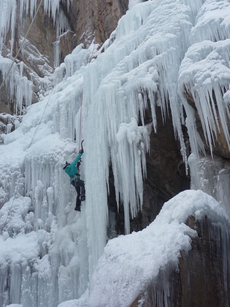
Ouray Ice Park, Colorado, ice climbing in winter
Wikimedia / Laurel F (CC BY-SA 2.0)
Ouray Ice Park — World's First Artificially Created Public Ice Park

The Ouray Ice Park was established in 1994 when the city began using municipal water rights to build ice in the Uncompahgre Gorge during winter. Before that, the gorge was simply a dangerous inaccessible canyon in cold weather. The transformation into a world-class climbing venue happened through volunteer labor and one inspired city engineer who realized the gravity-fed water supply could create massive ice structures with minimal cost.
The numbers
  • 2.2 miles of ice climbing terrain within a 0.5-mile gorge section
  • 150+ distinct named routes, grades WI1 through WI6+
  • Free and open to the public (the only free public ice park in the world)
  • Ouray Ice Festival (January): 250+ athletes, competitions, clinics: largest ice climbing event in North America

📷 Photo Credits — All Images from Wikimedia Commons

mt-sneffels-dallas-divide.jpg — Ken Lund (CC BY-SA 2.0)

ouray-colorado-town.jpg — Ken Lund (CC BY-SA 2.0)

san-juan-mountains.jpg — Mitchtobin (CC BY-SA 4.0)

bighorn-sheep-colorado.jpg — dw_ross (CC BY 2.0)

ouray-via-ferrata.jpg / ouray-ice-park.jpg — Laurel F (CC BY-SA 2.0)

uncompahgre-river-canyon.jpg — Bureau of Land Management (Public domain)

rio-grande-southern-railroad.jpg — Unknown photographer (Public domain)

camp-bird-mine.jpg — Russell Lee, Library of Congress (Public domain)

sagebrush-colorado.jpg — Matt Lavin (CC BY-SA 2.0)

gambel-oak.jpg — James St. John (CC BY 2.0)

serviceberry-bloom.jpg — Walter Siegmund (CC BY-SA 3.0)

mule-deer-colorado.jpg — USFWS Mountain-Prairie (CC BY 2.0)

osprey-ridgway.jpg — Andy Morffew (CC BY 2.0)

san-juan-volcanic-geology.jpg — Peter W. Lipman, USGS (Public domain)

ridgway-reservoir.jpg — Ken Lund (CC BY-SA 2.0)

chief-ouray-portrait.jpg — Brady-Handy Photograph Collection, Library of Congress (Public domain)

pronghorn-antelope.jpg — Larry Lamsa (CC BY 2.0)

crystal-river-valley.jpg — Dave Dugdale (CC BY-SA 2.0)

Orvis Hot Springs: No Wikimedia Commons image available (private facility). Card uses text-only format.