🎧 Audio Companion · Day 5
The Deepest Spring in the World: Pagosa Springs, Wolf Creek Pass, and the Battle for the Pagosa
Scroll along as you listen — photos and info cards match the audio order.
DAY 5 · PAGOSA SPRINGS
🎧 The Deepest Spring in the World — Pagosa Springs & Wolf Creek Pass
⬇️ Download episode MP3 (79 min)
0:00
--:--
Speed:
🌿 Chapter 0: The Smell Arrives First
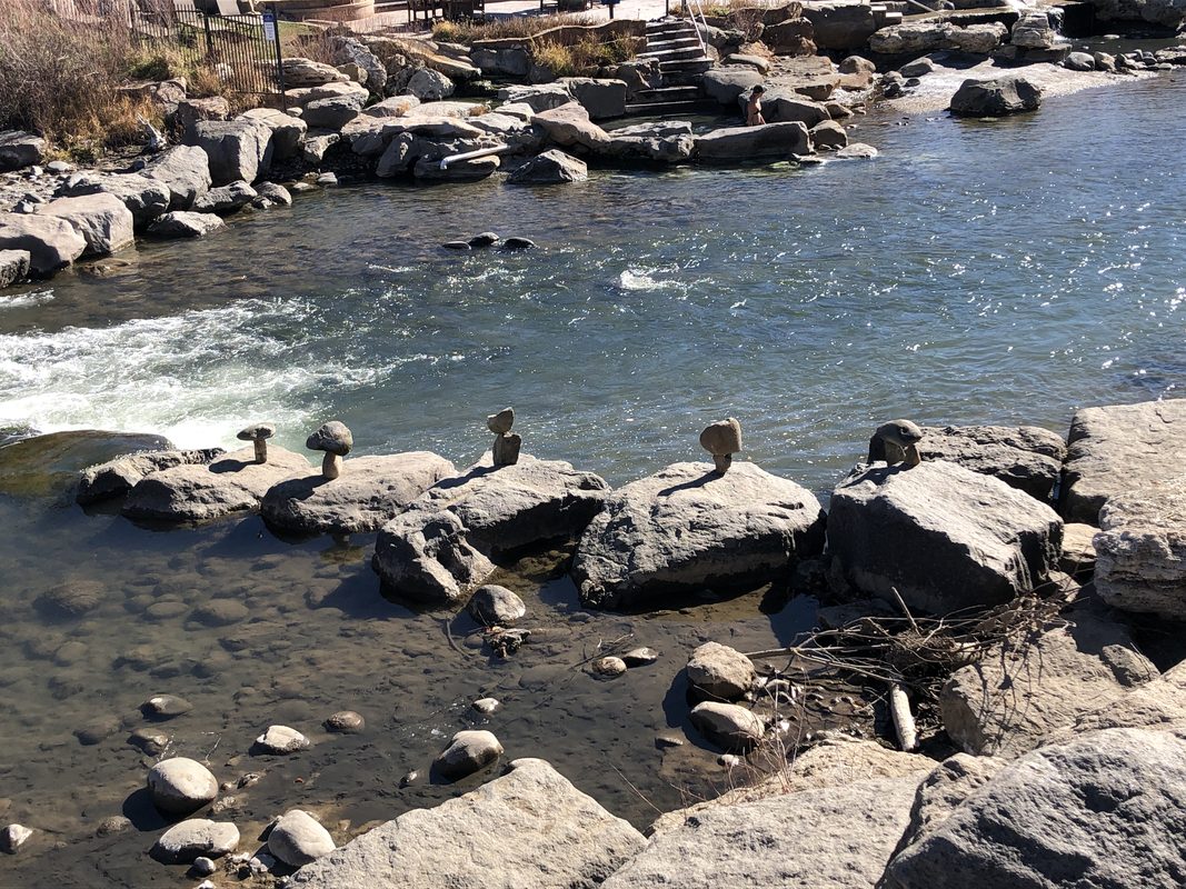
Wikimedia / Netherzone (CC BY-SA 4.0)
World's Deepest Known Hot Spring
The Great Pagosa Hot Spring
The smell arrives before the town does
Around mile seven on US-160 heading west from Wolf Creek Pass, the air inside the car changes. A faint mineral edge, a sulfur note so light it is more suggestion than smell. You are smelling the earth. The Great Pagosa Hot Spring sits in the middle of Pagosa Springs, and it is arguably the deepest known geothermal hot spring on the planet.
What you cannot get into
The water emerges at approximately 153 degrees Fahrenheit at the source, carrying dissolved hydrogen sulfide and 23 distinct minerals. You cannot get in the source pool. You would not survive it. But the resort has engineered a cascade of 25 pools down to the San Juan River's edge, each cooled to a soakable temperature, each fed from the same water.
The Ute word for it
The Ute had a word: pagosa. It meant healing waters or stinking waters, depending on which scholar you ask, and both translations are probably accurate. The Ute fought for these springs. So did the Jicarilla Apache. The contest over who owned the pagosa is one of the more dramatic stories in Colorado history, and it involves a Civil War veteran, a knife duel, and single combat that is verifiably documented.
🌔 Chapter 1: The Deepest Spring in the World
Jemez Lineament
What Makes Pagosa Singular in the Geological Literature
The 1,002-foot borehole
In 1982, a research borehole drilled into the Pagosa fault zone reached 1,002 feet before stopping. It did not reach the bottom of the hydrothermal system. It encountered water temperatures of 195 degrees Fahrenheit at that depth. The spring was still going deeper. The source of this water is somewhere below 1,002 feet, and no investigation to date has determined exactly how far.
The Jemez Lineament
The heat here comes from a geological feature not seen anywhere else on this trip: the Jemez Lineament. This northeast-trending belt of volcanic fields runs from eastern Arizona across New Mexico into Colorado, marking the boundary zone between two ancient crustal provinces. Pagosa sits near the northern end, where the mantle is closer to the surface than almost anywhere else in North America, and residual heat from volcanic activity 1 to 5 million years ago has not yet dissipated.
Why the smell, and what the minerals are
- Longer residence time at greater depth means more dissolved minerals
- The water carries sulfate, bicarbonate, sodium, calcium, magnesium, fluoride, and silica
- Dissolved hydrogen sulfide gas causes the sulfur smell; at the source pool, visible steam and bubbles mark the gas escaping from water too hot to hold it in solution
- The 1982 borehole remains the deepest direct investigation; what lies below 1,002 feet is still unknown
Thermophile microbiology
The source pool temperature sterilizes most bacteria in under 30 seconds, but sterilization is not biological absence. The orange and yellow mineral-staining organisms coating the pool edges are thermophile communities. Microbiologist Thomas Brock's work at Yellowstone in the 1960s, discovering organisms thriving above 140 degrees, eventually led to the PCR technology that drives modern genetic analysis. The thermal springs of Yellowstone gave medicine one of its most important diagnostic tools.
🚗 Chapter 2: Crossing Wolf Creek
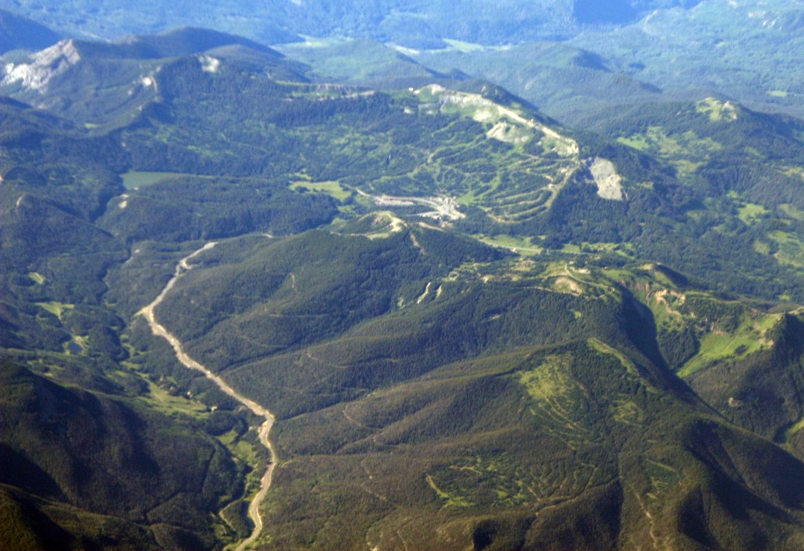
Wikimedia / Doc Searls (CC BY-SA 2.0)
Wolf Creek Pass — 10,857 Feet on the Continental Divide
The highest US highway in Colorado
US-160 climbs to 10,857 feet at Wolf Creek Pass, making it one of the highest paved US highways in the country. Until 1916 there was no road here at all. Until the 1930s, crossing it in anything but settled weather required substantial conviction. Even today, Wolf Creek Pass closes more often in winter than any other pass on the US highway system in Colorado.
The Continental Divide watershed
At the summit, you are standing on the Continental Divide. Water falling on the western slope flows toward the Colorado River and the Gulf of California. Water on the eastern slope drains into the Rio Grande system and eventually the Gulf of Mexico. Every drop on the west side is on a different ocean track than every drop on the east side. The San Juan River, which runs through Pagosa Springs, begins its life on this divide and immediately east of it.
What to watch on the climb
- Below 9,000 ft: ponderosa pine and Gambel oak, the parklike open forest from the Durango area
- Around 9,500 ft: Engelmann spruce begins appearing, first scattered, then increasingly dominant
- At the summit zone: full subalpine spruce-fir, dense and dark with spire-shaped crowns pointing upward
- Distance from Wolf Creek summit to Pagosa Springs: 17 miles downhill
Wolf Creek snowfall
The Wolf Creek area receives 400 to 450 inches of snow in a typical year, driven by Pacific moisture systems stalling against the Continental Divide at this geographic notch. Some years exceed 600 inches. Individual winters on record have exceeded 800 inches. There are ski areas in the Alps that do not see those totals.
⚔️ Chapter 3: The Battle for the Springs
1866
Captain Albert Pfeiffer and the Knife Duel at Pagosa
The Ute and the pagosa
The Ute treated the springs as a sacred site with practical purposes simultaneously. Soaking in hot mineral water relieves muscular pain and joint inflammation, effects understood experientially long before any physiology characterized them. The sulfur content has documented effects on skin conditions and bacterial infections that traditional users in many cultures observed over centuries. The pagosa was controlled, like most significant resources in the West, by whoever was strong enough to hold it.
Captain Albert Pfeiffer
Albert Pfeiffer was a German immigrant who arrived in New Mexico in the 1840s and became one of the most complex figures in the frontier Southwest. He served as Indian agent for the Ute in the 1850s, fought in the Civil War as a New Mexico Volunteer officer, and was the closest personal friend of Kit Carson, who described Pfeiffer as the most fearless man he had ever encountered. His wife was killed by an Apache raiding party in 1863, an event that intensified both his alignment with the Ute and his antagonism toward Apache groups.
The duel of 1866
A Jicarilla Apache party challenged the Ute claim to the springs through single combat: one representative from each group to fight until one side yielded the ground. The Ute asked Pfeiffer. The duel was conducted with Bowie knives. Pfeiffer, who was by this point in his fifties, wounded his Apache opponent within a short engagement. The Apache party withdrew. The springs remained in Ute territory for another fifteen years, until the Ute removal in the early 1880s.
The aftermath
- An American Army camp was established at the spring site in 1878 to manage the tense boundary between Ute and settlers
- Soldiers bathed in the sulfur water for skin conditions, the same practical knowledge the Ute had held for generations
- A bathhouse was operating by 1880; the Ute who had fought over these waters were by then on their reservation 80 miles to the west
- Albert Pfeiffer died in 1881 at Abiquiu, New Mexico, the same year the people he had defended were removed from this land
🪨 Chapter 4: What the Water Does
Physiology
Hydrogen Sulfide, Vasodilation, and Soaking at 7,079 Feet
What your body does in the pools
Heat immersion triggers a cascade of thermoregulatory responses: blood vessels near the skin surface dilate to release excess heat, which is why hot spring soakers turn visibly pink. Heart rate increases slightly. Cardiac output rises as the heart moves more blood to the skin periphery. This vasodilation temporarily drops resistance in the circulatory system, often producing a measurable drop in blood pressure for 30 to 60 minutes after a soak.
What hydrogen sulfide adds
The key compound at Pagosa is hydrogen sulfide, the source of the smell. Dissolved hydrogen sulfide in hot spring water at Pagosa concentrations crosses the skin barrier into the bloodstream in measurable quantities. Once absorbed, it acts as a vasodilator, relaxing smooth muscle in blood vessel walls through a mechanism involving nitric oxide signaling. Research published in the early 2000s established hydrogen sulfide as an endogenous gasotransmitter in humans: the human body produces small amounts of it naturally as part of normal cell signaling. You are not introducing a foreign compound. You are engaging a native system at elevated intensity.
Why altitude matters for soaking
At 7,079 feet, the vasodilation from heat and sulfur immersion produces a more pronounced cardiovascular response than at sea level, because the cardiovascular system is already running at a slightly elevated baseline effort. Twenty minutes in a 102-degree pool at 7,000 feet produces roughly the equivalent cardiovascular effect as 35 to 40 minutes at sea level. Hydration before soaking matters more at altitude.
The pool stages and the source
- River pools at the bottom: approximately 95 degrees Fahrenheit
- Upper pools: approximately 113 degrees
- Source pool at the top: approximately 153 degrees, off-limits for swimming
- The sulfur smell fades after about five minutes of immersion as the olfactory system habituates; it returns when you get out
- Your skin will feel slightly slippery and smoother after soaking: the sulfate and silica content working on your skin barrier
🏔 Chapter 5: The Weminuche
499,771 Acres
Colorado's Largest Wilderness Area
The scale
The Weminuche Wilderness covers just under 800 square miles of the San Juan Mountains. It encompasses portions of the Gunnison and San Juan National Forests, stretches from the Continental Divide westward to the Needle Mountains, and includes the headwaters of the San Juan, the Piedra, and the Los Pinos rivers. It is a roadless alpine landscape the size of a small state, with no motorized access and essentially no human infrastructure beyond trails.
The name
The Weminuche Wilderness was designated by Congress in 1975 and expanded in 1980 and 1993. Its name comes from the Weminuche band of the Southern Ute people, whose ancestral territory covered much of this high country before the removals of the 1870s and 1880s. It is a rare case where an American wilderness area carries the name of the Indigenous people who inhabited it.
The Continental Divide Trail through the Weminuche
The CDT passes through the Weminuche for approximately 100 miles. This stretch is among the most exposed and demanding on the entire 3,100-mile trail. No roads cross it. Resupply options are minimal. Weather above treeline in June and July produces afternoon thunderstorms that arrive faster than inexperienced hikers expect.
Access from Pagosa
- Wolf Creek and South Fork corridors to the north are the most accessible entry points
- The Piedra River canyon to the west: lower visitation, denser forest, designated Wild and Scenic River
- The Needle Mountains section contains Sunlight Peak, Windom Peak, and Eolus Peak, some of Colorado's most technically demanding fourteeners
- The Needle Mountains are accessible via D&SNG request stops at Needleton and Elk Park, as covered in the Durango episode
What the Weminuche preserves, more than any specific trail or summit, is consequence. When you are above treeline and a storm builds over the divide, there is nothing between you and it. The mountains are not threatening. They are simply indifferent to human preference, and that indifference is one of the more valuable things the wilderness designation has managed to keep intact.
🌲 Chapter 6: Engelmann Spruce and the High Forest
Engelmann Spruce — The Dominant Tree of the Subalpine Zone
Picea engelmannii
Identification: the sharp needle test
Above 9,500 feet in the San Juan Mountains, ponderosa pines give way to the subalpine zone. The signature species: Engelmann spruce and subalpine fir. You can tell them apart by touch. Spruce needles are sharp enough to prick your fingers if you grab a branch firmly. Fir needles are soft and flat. The bark of a young subalpine fir is smooth and gray with resin blisters. Spruce bark is scaly and brownish-gray. Experienced foresters use the abbreviation SE/AF for spruce-fir forest, the two species so consistently co-occurring that naming only one is ecologically incomplete.
Slow growth, deep time
Engelmann spruce is a slow-growing tree: a trunk 18 inches in diameter may represent 150 to 200 years of growth. It is shade-tolerant, meaning it can establish and grow slowly under the canopy of other trees before working its way upward. This shade tolerance makes it the dominant climax species of the subalpine forest: given enough time, spruce will eventually outcompete most other species for canopy position.
Compressed growing season at Wolf Creek
At the summit zone, snow does not fully melt until June and begins accumulating again in September. The trees have roughly ten to twelve weeks to conduct all their photosynthesis, root growth, and seed production. A core pulled from a mature Engelmann spruce at Wolf Creek Pass would show decades of years where essentially nothing happened above ground, recorded as a line barely visible under a hand lens.
Krummholz: the crooked wood
- At the upper subalpine zone around 11,500 feet, the trees begin to lose their upright form
- They shrink, bend, grow horizontally away from the prevailing wind, cluster together for thermal mass
- This is the krummholz, from the German for crooked wood
- Krummholz trees that are waist-high at the edge of a trail may be a hundred years old; the one that looks like a shrub may have started as a seed during the Civil War
- Above the krummholz: tundra, then rock
🦌 Chapter 7: Moose in Colorado
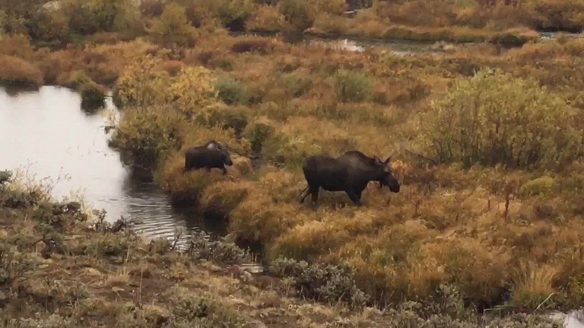
Wikimedia / PEO ACWA (CC BY 2.0)
Introduced 1978
Moose — Not Native, Now Thriving
Alces alces shirasi
The reintroduction story
Moose are not native to Colorado. The first animals arrived in 1978 when the Colorado Division of Wildlife brought twelve moose from Utah and released them near North Park. A second introduction followed in 1987 and 1988 from Wyoming; a third in 1991 targeted the Laramie River valley. The animals established breeding populations, expanded their range, and began moving south and west on their own. By the late 1990s, moose had reached the San Juan Mountains under their own locomotion. The Pagosa region has among the highest moose densities in Colorado.
Late May is calving season
Female moose calve in late May and early June. A cow will separate from her calf of the previous year just before giving birth, so yearlings the size of a large horse are suddenly moving around on their own, often near roads and river banks. A newborn moose is 30 to 35 pounds at birth, absurdly small relative to a mother who weighs up to 1,000 pounds. The calf is long-legged and wobbly for the first few days and stays very close to the cow.
Bull velvet antler growth
Male moose in late May are in velvet. The racks grow from April and can add up to an inch per day during peak season, making moose antlers among the fastest-growing tissues in any mammal. The blood vessels running through growing velvet antlers are extensive and visible from a distance. A mature bull's rack can reach 60 to 70 inches across at full size; in late May it is several months from finished dimensions.
The safety question requires directness
Cow moose in calving season are among the most dangerous large mammals in North America by incident count. More people are injured by moose in North America each year than by any other large mammal, including bears. If you encounter a cow with a calf on foot: give her a wide berth, do not get between her and the calf, and if she charges, get behind something solid. Standard bear behavior of making yourself large and speaking calmly does not work with a cow moose with a calf. She is not bluffing, and she will follow through.
🧉 Chapter 8: Merriam's Turkey
Rocky Mountain Subspecies
Merriam's Turkey — The Mountain Gobbler
Meleagris gallopavo merriami
Not your Thanksgiving turkey
Wild turkeys in Colorado are Merriam's turkeys, a Rocky Mountain subspecies that differs meaningfully from the eastern wild turkeys most people picture. The Merriam's is a bird of ponderosa pine and mixed mountain forest. Its tail fan and wing tips are whiter than the eastern subspecies, giving it a striking contrast between the iridescent bronze body and the bright white margins of the spread tail. It regularly winters at 7,000 to 8,000 feet and moves up to 9,500 feet in summer.
Late May gobbling
Late May is the back end of turkey breeding season, and the gobblers are at their most vocal. The gobble is the primary long-distance location call, used to attract hens and establish dominance. Gobblers also produce the spit-and-drum: a rapid puff of expelled air followed by a low-frequency vibration produced by fanning the wings against the chest, which has to be heard at close range to be believed as something a bird is making.
Wild vs. domestic
A domestic broad-breasted white turkey cannot fly, cannot navigate terrain more complex than a flat pen, and requires active human management to survive. A wild Merriam's turkey can fly a quarter mile at a time, roosts in trees every night, covers ten miles of rugged terrain in a day, and lives 10 to 12 years in the wild. Same species. Unrecognizably different animals.
Where to look
Look at the edges: not deep in the forest, not in the open field, but at the margins where the two habitats meet. A flock of hens moving through open grass in early morning, with one or two gobblers displaying at the rear. The transition zone where ponderosa gives way to the first Engelmann spruce is where turkey density peaks in the Pagosa area. Pagosa consistently produces gobblers with significant age and body weight, earning a reputation among western turkey hunters that exceeds its geographic profile.
🌊 Chapter 9: The River at the Bottom of the World
The San Juan River — Snowmelt, Geothermal, and 383 Miles to the Colorado
Origin and destination
The water flowing through Pagosa Springs today started as snow on the Continental Divide above Wolf Creek Pass. The San Juan River rises on the eastern flanks of the San Juan Mountains, flows west through Pagosa Springs, continues across northwestern New Mexico, is impounded at Navajo Lake, released into canyon country west of Farmington, and eventually joins the Colorado River at the Utah-Arizona border in what is now Lake Powell. Total length: approximately 383 miles. Total watershed: roughly 24,000 square miles spanning Colorado, New Mexico, Utah, and Arizona.
Peak runoff in late May
At Pagosa Springs, the river is young and fast. This is peak runoff timing: the winter snowpack on the Continental Divide above town is releasing through the river system now, and the San Juan runs higher and faster in late May than it will by August. Aquatic insects, stoneflies, mayflies, and caddisflies are present in the upper San Juan in healthy numbers. All three are indicator species for cold, oxygen-rich, clean water.
The geothermal fingerprint in the water column
The Great Pagosa Hot Spring contributes its flow to the San Juan River continuously. The elevated sulfate and silica concentrations from the spring have been measured in river chemistry studies well into New Mexico, traceable in the water column as a chemical fingerprint of what the earth is adding at Pagosa. In winter, the geothermal input keeps the river from freezing as quickly downstream of the spring.
Water rights and the Navajo Nation
- The San Juan River's lower course runs through Dine homeland; the river's health is not an abstract metric to communities that draw from it directly
- Southern Ute tribe water rights in the San Juan system are legally active, subject to ongoing negotiations and federal adjudications since the 1970s
- The allocation of the river's flow reflects treaties, court orders, and compacts stretching back to the 1920s
⏳ Chapter 10: 1923 Moment: The Road Over the Mountain
1923
Wolf Creek Pass in 1923 — When Crossing the Mountain Was an Achievement
What "road" meant in 1923
The Colorado State Highway Commission had taken over the former county wagon road in 1916. By 1923, the pass was technically open to automobiles. But the grade was 11 percent in places. Most 1923 automobiles could barely manage 7 or 8 percent grades without overheating. The road surface was unpaved: alternately muddy and deeply rutted when wet, and layered with loose dust when dry. There were no guardrails. The drop on the western side in certain sections was 300 to 400 feet to the canyon bottom. The road was single-lane on most upper grades.
The cars of 1923
Model T Fords, early Dodge Brothers trucks, Studebakers. Their drivers wore goggles against the dust, tied luggage to the running boards, and carried tire patching kits because flat tires on unpaved mountain roads were routine rather than exceptional. Rocky Mountain Motor Tour Guides published route descriptions for passes like Wolf Creek: allow six to eight hours from Durango to Alamosa, bring extra radiator water, plan to negotiate the grade in low gear. Crossing Wolf Creek in 1923 was a mechanical achievement as well as a geographic one.
Pagosa Springs in 1923
A ranching, logging, and sheep-grazing community of perhaps 1,500 people. The Piedra Valley and the upper San Juan corridor were sheep country: hundreds of thousands of animals were trailed up to national forest grazing allotments each summer. Wool markets in Denver determined whether a sheep ranching family had a good year or a hard one. The hot springs had been in commercial operation since 1880. A traveler arriving after the pass descent would have been ready for the sulfur pools in a way that specifically physical and dusty travel makes you ready for them.
The 1923 television connection
This is the world that Taylor Sheridan's 1923 series is set in. The show is geographically Montana and Wyoming, but the economic and social texture is accurate for this region too: the ranching economy dependent on a single commodity market, the remoteness that made every supply run a logistics operation, the mountain passes that separated communities in winter not inconveniently but completely. The crossing that took six to eight hours in 1923 now takes 45 minutes. The springs have not changed. The smell of the earth below Pagosa is the same smell a Model T driver with a steaming radiator noticed when the descent finally put him close enough to the river to roll the windows down.
📍 Chapter 11: Come Back For This
Pagosa Springs — What Requires a Return Trip
♨️ The Springs Resort and Spa
Hot Springs Blvd, Pagosa Springs. 25 pools staged from 95 degrees at the San Juan River level to 113 degrees in the upper pools. The source pool at 153 degrees is observable from close range. Rooftop pools with San Juan Mountain views. The evening experience, when steam rises visibly off the source pool in cooling air, is specific to this one place on earth.
🏝 Piedra River Canyon Trail
The most rewarding hiking accessible from Pagosa without committing to a backpacking trip. The Lower Piedra Trail follows the river through sandstone canyon walls for 5 to 6 miles. Trailhead off County Road 600, about 25 miles northwest of town. Moderate difficulty, minimal elevation gain. One of the few undammed river corridors in the entire San Juan drainage. Worth doing.
🏔 Continental Divide Trail at Wolf Creek Pass
Trailhead at the Wolf Creek Pass summit (10,857 ft). A day hike north along the divide takes you above treeline within two miles, with views east into the San Luis Valley and west across the Weminuche. You start at 10,857 feet and climb from there. Not for people still acclimatizing to altitude.
🚴 San Juan River Whitewater
Class II and III through Pagosa during peak snowmelt runoff (late May through early July most years). Pagosa Outside and Pagosa Rafting Outfitters run half-day guided trips. Appropriate for beginners with a guide in medium flows; demands prior experience in high water.
🎕 Fly Fishing
The upper San Juan above Pagosa and the Piedra River are serious fishing with native cutthroat in productive holding water. Late May means high, fast water: plan early mornings before peak daily flow. The lower San Juan below Navajo Dam in New Mexico is one of the West's premier tailwater fisheries.
🚴 Turkey Springs Trail System
Roughly 40 miles of purpose-built singletrack ranging from beginner to technically demanding intermediate mountain biking. Sits in the ponderosa-spruce transition zone, which means forest variety and views. Accessible from town.
⛳️ Wolf Creek Ski Area
Six miles northwest of town. Receives more natural snow than any resort in Colorado most years: 400-plus inches average, some years over 600. Opens around Thanksgiving, typically operates into April. Lift ticket prices reflect its position off the major resort corridor. Weekday skiing in a high-snow January is among the better values in Colorado.
🍶 Pagosa Brewing and Grill
Brewpub on the river with a kitchen that takes itself seriously. The beer list includes seasonals; the green chile pork is worth ordering if it is on the current menu. Price point is reasonable for a mountain town.
🍽 Alley House Grille
The upscale option in town: small dining room, seasonal menu, wine list better than you expect from a community of 2,000. Reservations matter from June through August.
☕ Higher Grounds Coffee and Bakery
Opens early, makes good pastry, understands what altitude does to baking. Walkable from the springs if you are staying at the resort.
🍴 Waterfall Restaurant at The Springs
The resort's own restaurant has improved its kitchen in recent years. Eating on the rooftop deck in the evening while steam rises from the source pool below is an experience specific to this one place on earth. The setting would carry mediocre food. The food is better than mediocre.
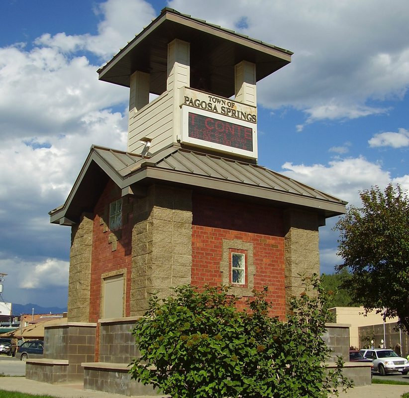
Wikimedia / WhisperToMe (Public domain)
The Town That Smells Like the Earth
The springs at Pagosa have been running continuously through more than 200 years of recorded observation by American and Spanish visitors, and almost certainly longer based on evidence of Ute and Apache use stretching back centuries further. On human timescales, this spring is not cooling down. It is drawing on a heat reservoir that is effectively inexhaustible.
The borehole drilled in 1982 remains the deepest direct investigation of the Pagosa system. What lies below 1,002 feet under Pagosa Springs remains, for the moment, unknown. The spring was still going deeper when the drill stopped.
Pagosa rewards time. A dedicated return, with an evening at the springs, a day hike on the Piedra, and a night at the resort listening to the river, would be a very good few days in the southern San Juans.
📷 Photo Credits — All Images from Wikimedia Commons
great_pagosa_hot_spring.jpg — Netherzone, Pagosa Hot Springs soaking pools on the San Juan River (CC BY-SA 4.0)
wolf_creek_pass.jpg — Doc Searls from Santa Barbara, USA, Wolf Creek Pass and Ski Area (CC BY-SA 2.0)
moose_colorado.jpg — PEO ACWA, Shiras Moose and calf in Colorado (CC BY 2.0)
pagosa_springs_town.jpg — WhisperToMe, Pagosa Springs Colorado Tower (Public domain)