🎧 Audio Companion · Day 3

Ouray & the Million Dollar Highway

Scroll along as you listen — photos and info cards match the audio order.
Colorado Hot Springs Road Trip · May 2026 · Elevation to 11,018 ft
DAY 3 · OURAY
🎧 Ice, Fire, and the Road That Shouldn't Exist: Ouray, Red Mountain Pass, and Silverton

⬇️ Download episode MP3 (99 min · 95MB)
🎧 EXTENDED PODCAST
Ridgway + Ouray Deep Dive — 3 hrs · 84MB
0:00 --:--
Speed:
❄ Chapter 1: Ice Age Glaciation — Who Carved These Mountains
U-shaped glacial canyon walls in the San Juan Mountains, Colorado
Wikimedia / BLM (Public domain)
~20,000 years ago
Ice Age Glaciation — How the San Juans Got Their Shape

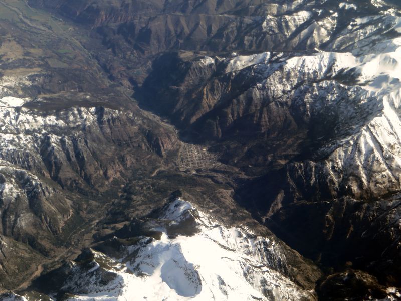
What you're seeing all around Ouray
Every dramatic curve in the terrain around Ouray is a glacial signature. The broad, flat-bottomed valleys with steep walls rising abruptly on both sides are U-shaped valleys, the hallmark of glacial carving. Rivers carve V-shapes; glaciers carve U-shapes. The difference is the sheer mass of ice grinding the valley floor flat while the walls remain vertical.
Cirques, aretes, and hanging valleys
  • Cirque: the bowl-shaped amphitheater at the head of a glaciated valley, where the glacier originated. The natural rock seating bowl that gives Ouray the nickname "Switzerland of America" is a classic cirque.
  • Arete: a knife-edged ridge where two cirques carved from opposite sides. The dramatic fins on the peaks above Ouray are aretes created when glaciers on both flanks ate toward each other.
  • Hanging valley: a tributary valley that ends abruptly above the main valley floor, where a smaller glacier joined a larger one. Box Canyon Creek and its waterfall hang above the Uncompahgre Valley for exactly this reason.
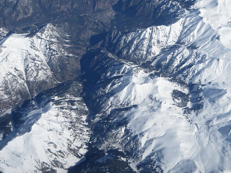
The Last Glacial Maximum
At the peak of glaciation approximately 20,000 years ago, the San Juan Mountains were buried under ice thousands of feet thick. The ice didn't melt away all at once. It retreated and advanced several times as climate fluctuated. The terrain you're driving through today was still ice-covered as recently as 12,000 to 15,000 years ago. On a geological time scale, Ouray's landscape was born yesterday.
🚗 Chapter 2: The Million Dollar Highway — The Road That Shouldn't Exist
US-550 south of Ouray, hanging on cliff walls above the Uncompahgre Gorge
Wikimedia / Dcoetzee (CC BY-SA 4.0)
US-550: Ouray to Silverton — No Guardrails on Purpose

The basic facts
  • US-550 from Ouray south to Silverton: 25 miles, crests at Red Mountain Pass at 11,018 ft
  • Built originally by Otto Mears as a toll road in the 1880s, paved in the 1920s
  • Sections have no guardrails where the road hangs on cliff faces above sheer drops
  • 2-lane road with oncoming traffic around blind curves at 10,000 ft
  • Closed in winter after heavy snowfall; avalanche country for most of the route
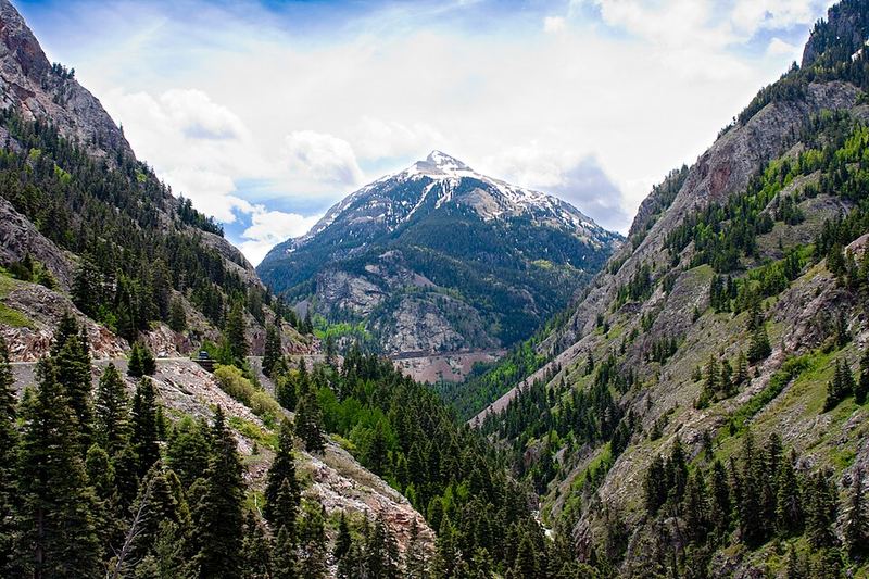
Why no guardrails
The Colorado Department of Transportation has been asked this question for decades. The official answer: guardrails create a false sense of security. On a road this narrow with drops this severe, a guardrail wouldn't stop a vehicle from going over. It would just slow it down on the way. The psychological effect of seeing the edge keeps drivers appropriately cautious. Whether you find this convincing depends on how you feel about seeing 1,000-foot drops directly off your passenger window.
The name theories
Nobody agrees on why it's called the Million Dollar Highway. Three competing theories have circulated since the 1920s: (1) the original road cost approximately one million dollars per mile to build through the terrain, (2) the gold-bearing ore in the road fill material was worth a million dollars, (3) the view is worth a million dollars. All three may be partially true. The name stuck regardless of origin.
The 1923 connection
In 1923, the road was newly paved and a genuine engineering achievement. Before paving, the route from Ouray to Silverton required a horse or mule team and took a full day. The automobile was making its first real assault on this terrain, and the improved road brought Silverton into reach of day-trippers from Ouray for the first time. The San Juan mountain communities were just beginning to understand that tourism might outlast mining as an economic driver.
⛰️ Chapter 3: Red Mountain Pass — Iron Sulfide Chemistry
Red Mountain Pass, Colorado, the iron-red mountains above the Million Dollar Highway
Wikimedia / Famartin (CC BY-SA 4.0)
⛰ 11,018 ft
Red Mountain Pass — Why These Mountains Are Red

The chemistry is different from Ridgway's red
If you drove through Ridgway, you saw red rock there too, the Cutler Formation with its iron oxide coating on sandstone grains. The red of Red Mountain is a completely different chemical process. Here, the brilliant orange-red comes from oxidizing iron sulfide minerals: pyrite (fool's gold), pyrrhotite, and chalcopyrite, exposed at the surface by mining and natural weathering.
The two reds compared
  • Ridgway/Cutler Formation red: hematite (iron oxide, Fe₂O₃) coating Permian-age sandstone grains. 280 million years old. Stable and permanent once formed.
  • Red Mountain red: iron sulfide (FeS₂ and relatives) oxidizing in the presence of water and oxygen. This reaction is ongoing. The mountain is still turning red in real time. Acid mine drainage from the old mines accelerates the process.
What created the sulfide minerals
The iron sulfides at Red Mountain are hydrothermal deposits, the same volcanic plumbing system that created the gold and silver deposits at Silverton and Camp Bird. Superheated water carrying dissolved minerals circulated through fractures in the caldera system as it cooled 25 to 28 million years ago. Where conditions were right, sulfide minerals crystallized out. Where they've been exposed and oxidized since, the mountains glow orange-red.
The mines
Red Mountain Town (now a ghost town) at the summit had a post office and 1,000 residents at its peak in the 1890s. The Yankee Girl, Guston, and National Belle mines produced millions of dollars in silver. All are abandoned now. The acid drainage from the tailings creates the vivid orange-yellow-red streaks visible in the creekbeds below the pass.
🌊 Chapter 4: Box Canyon Falls — 1.7 Billion Years Old
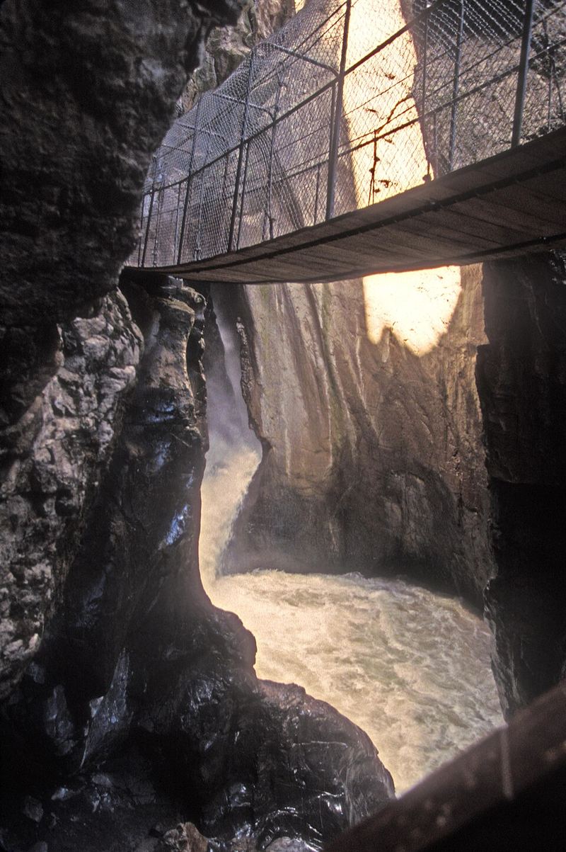
Box Canyon Falls, Ouray, Colorado, waterfall through Precambrian schist gorge
Wikimedia / Mfield (CC BY-SA 3.0)
Box Canyon Falls — The Slot Through Ancient Rock

The basics
  • Box Canyon Creek drops 285 feet through a slot gorge in Precambrian metamorphic schist
  • The gorge is only 20 feet wide at the bottom: the roar at the base is extraordinary
  • The dark, glittering rock of the gorge walls is 1.7 billion years old
  • One of the oldest rock formations visible at the surface anywhere in Colorado
How the gorge formed
Box Canyon is a hanging valley from the glaciation era. When the main Uncompahgre Glacier carved its U-shaped valley much deeper than the Box Canyon tributary glacier, Box Canyon Creek was left hanging far above the new valley floor. The stream has been cutting down through the schist ever since, carving the dramatic slot rather than a V-shaped canyon because the metamorphic rock has strong vertical fracture planes that the water exploits. The result is a nearly parallel-walled gorge rather than a widening canyon.
The Precambrian rock
The dark, layered schist and gneiss at Box Canyon is part of the Uncompahgre Formation, ancient metamorphic rock that predates the San Juan volcanic field by more than 1.6 billion years. It was buried deep in the crust, cooked and compressed by pressure into its folded, glittering form, then uplifted and exposed by erosion. You're looking at the deep basement of a continent. Everything above it, including the volcanic San Juan Mountains, was built on top of this ancient floor.
⛏ Chapter 5: Silverton — The Frozen Mining Town
Victorian commercial buildings in a San Juan mountain mining town, Colorado
Wikimedia / Famartin (CC BY-SA 4.0)
Founded 1874 · Population ~600 today
Silverton — Almost Unchanged Since 1890

Why it looks the way it does
Silverton's downtown commercial district looks almost exactly as it did in 1890, and not because anyone preserved it. It looks this way because nothing was built to replace it. When the mining economy collapsed and the narrow-gauge railroad stopped delivering tourists, there was no economic driver for demolition or redevelopment. The buildings simply stood, survived, and became historically significant by remaining in place.
The numbers
  • Population peaked at roughly 2,000 in 1900 during the silver boom
  • Isolated by terrain until the Denver and Rio Grande Western railroad arrived from Durango in 1882
  • Year-round population today: approximately 600 people
  • Elevation: 9,318 ft, the highest incorporated municipality in Colorado
  • The town sits inside the Silverton caldera margin, which explains why the ore was concentrated here
Blair Street
Blair Street ran parallel to the main commercial district and was Silverton's saloon, gambling, and brothel row during the mining boom. At its peak it had more than 30 establishments operating simultaneously. It was the economic engine that kept the local economy moving between mining paydays. Several buildings survive. The Durango and Silverton Narrow Gauge Railroad terminates one block away, bringing tourists who now walk Blair Street for an entirely different kind of experience than its original clientele sought.
The caldera connection
The Silverton caldera complex erupted between 28 and 26 million years ago. The hydrothermal fluids that circulated through the caldera system as it cooled deposited the gold and silver that made Silverton and Ouray County the richest mining district in Colorado. The billion-dollar wealth extracted from this terrain flows directly from the supervolcanic geology of the San Juans. The ore was a byproduct of the same system that built the mountains.
💤 Chapter 6: Altitude Physiology at 11,018 ft
What 11,018 Feet Does to Your Body

The oxygen situation
At Red Mountain Pass, the air contains the same 21% oxygen as at sea level. What changes is the barometric pressure, which determines how many oxygen molecules hit your lung tissue with each breath. At 11,018 ft, atmospheric pressure is approximately 67% of sea level pressure. You are getting roughly two-thirds of the oxygen per breath that you would get at Denver's airport.
Hemoglobin saturation
At sea level, hemoglobin in your blood is approximately 98% saturated with oxygen. At 11,000 ft in an unacclimatized person, this drops to 90-93%. The oxyhemoglobin dissociation curve is nonlinear: the drop from 98% to 93% feels manageable, but the same curve gets much steeper below 90%. If you're exerting yourself, carrying gear, or already have any pulmonary or cardiac issues, that margin disappears quickly.
The 2,3-DPG adaptation
Your body's first adaptation to altitude isn't making more red blood cells. That takes weeks. The immediate response, beginning within hours, is increasing the production of 2,3-diphosphoglycerate (2,3-DPG), a molecule that makes hemoglobin release oxygen more readily to your tissues. It's a biochemical workaround: since each breath delivers less oxygen, your body engineers hemoglobin to give more of what it carries to your cells. This adaptation is largely complete in 24 to 48 hours.
UV radiation
Ultraviolet radiation increases approximately 4% per 1,000 feet of elevation gain, because there's less atmosphere to absorb it. At 11,018 ft, UV is roughly 25% more intense than at sea level. On a clear May day with snow reflecting the radiation upward from below, UV exposure doubles again. Sunscreen is not optional at Red Mountain Pass, it's physiology.
Symptoms to watch for
  • Headache, especially if it came on after arriving at elevation: early AMS (Acute Mountain Sickness)
  • Shortness of breath at rest (not just exertion): worth paying attention to
  • Nausea, dizziness, unusual fatigue: AMS continuing to develop
  • The treatment: descend. Even 1,000 ft makes a measurable difference.
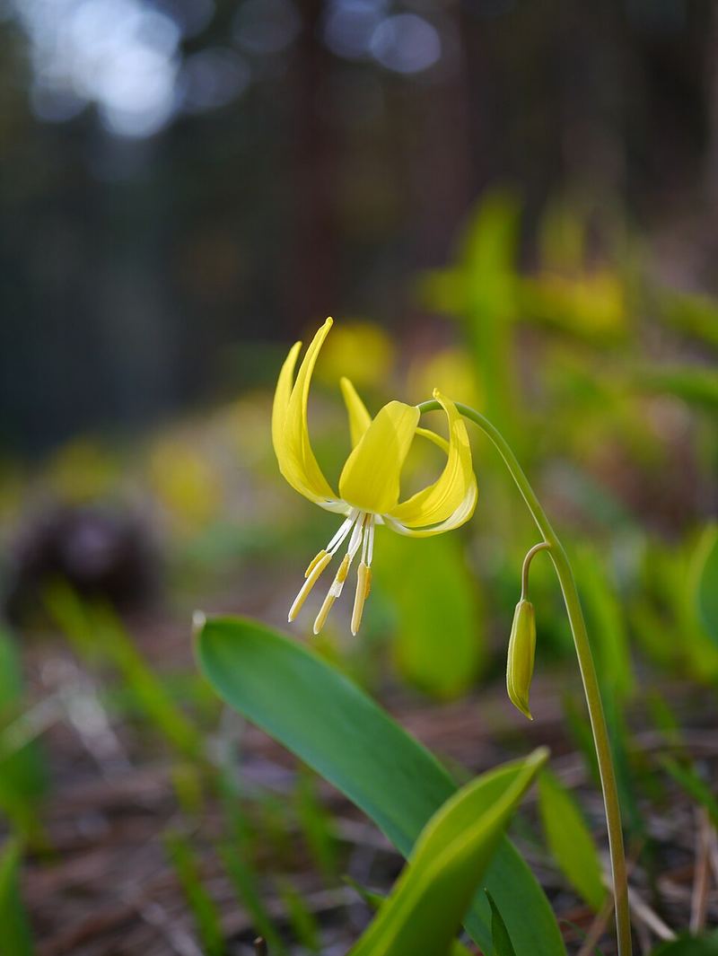
🌿 Chapter 7: Alpine Wildflowers — What Blooms Through Snow
Glacier lily (Erythronium grandiflorum) emerging through snowmelt, yellow flowers
Wikimedia / Walter Siegmund (CC BY-SA 3.0)
Glacier Lily — The Flower That Grows Through Snow
Erythronium grandiflorum

The glacier lily is often photographed emerging directly through snow, its yellow petals opening while the ground is still frozen. This isn't a coincidence. Glacier lilies photosynthesize rapidly in the brief window when sunlight reaches them before the snowmelt is complete, front-loading energy production before taller plants establish a canopy. They can bloom within hours of snowmelt exposure.
At late May elevation, look for
  • Glacier lily at snowmelt edges, 9,000 to 11,000 ft: bright yellow, nodding, often in masses
  • Sky pilot (Polemonium viscosum) on rocky slopes, sticky and strongly scented to attract bumblebees at altitude where other pollinators don't go
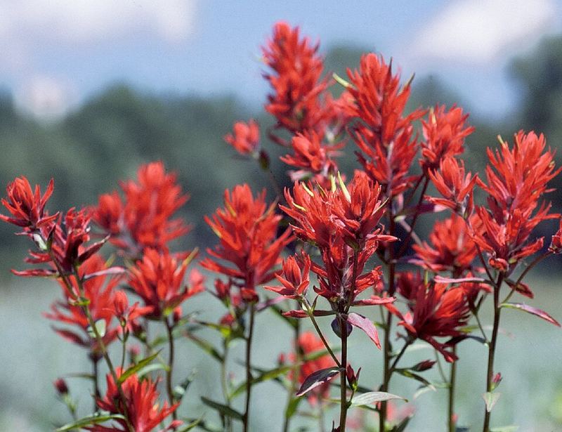
  • Indian paintbrush beginning in the lower alpine zone: flame-red bracts, actually partially parasitic on neighboring grasses
  • Alpine avens (Geum rossii): yellow flowers, mat-forming, common in open tundra above treeline
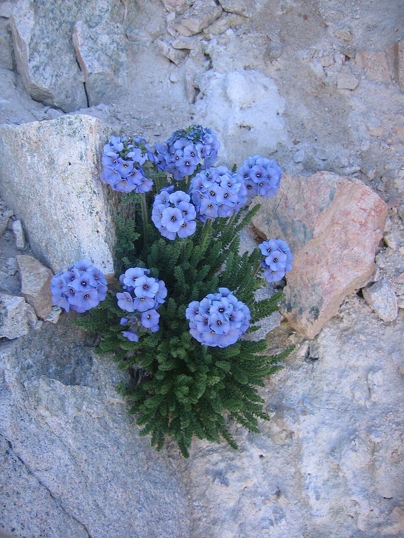
Sky pilot (Polemonium viscosum) electric blue-purple flowers on alpine rocky slope
Wikimedia / Robb Hannawacker, NPS (Public domain)
Sky Pilot — The High-Altitude Pollination Problem
Polemonium viscosum

Sky pilot blooms electric blue-purple on rocky slopes at 11,000 to 14,000 ft, higher than almost any other flowering plant in Colorado. The name is self-explanatory. The smell, however, is something less poetic: a strong skunk-like odor produced by sticky glands on the leaves and stem. The scent isn't a defect. It's precision advertising aimed at bumblebees, the only pollinators active at this altitude and in this temperature range. Honey bees don't operate above about 10,000 ft. Bumblebees generate body heat independently and can forage in near-freezing conditions.
The krummholz zone
As you approach treeline at approximately 11,500 ft in the San Juans, the subalpine fir and Engelmann spruce trees stop growing upright. Instead they grow in prostrate, wind-sculpted mats pressed against the ground: krummholz, from the German for "crooked wood." This isn't a separate species. It's the same trees that grow 60 feet tall in the forest below, genetically identical, but shaped entirely by the mechanical force of winter wind and snow abrasion. The trees at the very edge of treeline are sometimes hundreds of years old and only inches tall.
Indian paintbrush (Castilleja chromosa) flame-red bracts on rocky slope
Wikimedia / Stan Shebs (CC BY-SA 3.0)
Indian Paintbrush — The Half-Parasite
Castilleja spp.

The brilliant red-orange flame of Indian paintbrush is actually the bracts (modified leaves) surrounding small, inconspicuous flowers. The color comes from the bracts, not the flowers themselves. Paintbrush is hemi-parasitic: it photosynthesizes normally but also sends root connections into the roots of neighboring plants, especially grasses, and taps their water and nutrient supply directly. Removing paintbrush from a meadow often isn't possible without also removing its host plants.
Pollinators
The tubular flower structure and red color are specifically adapted to attract hummingbirds, which have red color vision and can reach nectar that insects cannot. At 9,000 to 11,000 ft in late May, broad-tailed hummingbirds are migrating through exactly this elevation band on their way to higher breeding grounds. A paintbrush field is a critical refueling stop.
🐰 Chapter 8: Pika — Climate Sentinel of the Talus Slopes
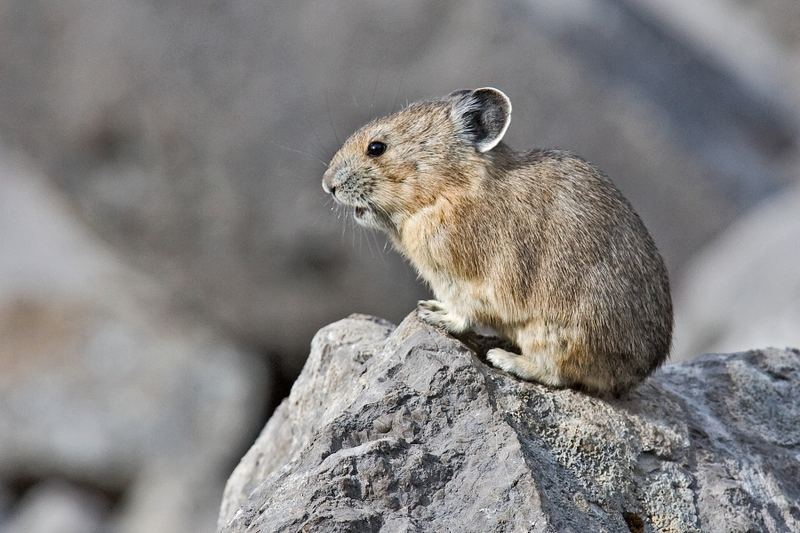
American pika (Ochotona princeps) on talus boulders above treeline
Wikimedia / USFWS (Public domain)
American Pika — Cannot Tolerate Heat Above 78°F
Ochotona princeps

The pika looks like a small round hamster with rounded ears and no visible tail. It is not a rodent. It's a lagomorph, the same mammalian order as rabbits and hares, and it's the only lagomorph that lives above treeline in the Rocky Mountains. Pikas live in boulder fields, using the air spaces between rocks for temperature regulation and the rock surfaces for sunning and calling.
The climate vulnerability
Pikas cannot tolerate body temperatures above approximately 78 degrees Fahrenheit. Prolonged exposure to temperatures at or above this threshold is lethal. As average temperatures have risen across the Rocky Mountains, pikas have moved upslope to find cooler habitat, and entire populations in lower mountain ranges have disappeared. In some areas of the Great Basin, pikas have run out of mountain. There is nowhere higher to go. They are considered one of the most temperature-sensitive mammals in North America.
The haying behavior
Pikas do not hibernate. They survive winter in their boulder fields by living under the snow, insulated from the extreme cold above. To do this, they spend the entire summer cutting vegetation, drying it in the sun, and stacking it into "haypiles" in sheltered rock crevices. A single pika may move several pounds of vegetation to its haystack over the course of a summer. The haypile is their winter pantry. You may smell the haypiles before you see the pika: a sweet, grassy scent from the drying plants.
How to find them
Listen for a sharp, nasal "eek" from talus slopes above treeline. The call is an alarm, announcing your presence to neighboring pikas. Once you hear one, stand still for a minute. The pika will almost certainly reappear on a prominent rock nearby to assess the threat. They are curious and territorial, and the same boulder will often be used as a calling rock for years by successive occupants.
🦅 Chapter 9: White-tailed Ptarmigan — Colorado's Alpine Bird
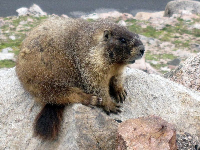
Yellow-bellied marmot on alpine boulders above treeline, Colorado Rockies
Wikimedia / mtneer_man (CC BY-SA 2.0)
Alpine Residents: Ptarmigan and Marmot

White-tailed ptarmigan
Colorado's only bird that spends its entire life above treeline. Pure white in winter, the ptarmigan molts to a mottled brown-white by late May, which creates extraordinary camouflage against the snow-and-rock terrain of the alpine zone. Their survival strategy relies entirely on invisibility: they hold motionless rather than flushing, which means you can walk to within a few feet without triggering flight. Look for them in willow patches near snowfields between 11,000 and 13,000 ft.
Feathered feet
Ptarmigan have feathers on their feet in winter, which act as snowshoes and insulation simultaneously. Their toes spread wide when walking on snow, distributing their weight. The feathers trap air and provide a thermal layer between the foot and the frozen surface. No other bird in Colorado has this adaptation. It's the reason ptarmigan can remain active on alpine snowfields in conditions that would be fatal to most other species.
Yellow-bellied marmot
The marmot is the loudest animal in the alpine zone. Its sharp, high-pitched whistle alarm call carries across boulder fields and has earned it the name "whistle pig." Marmots emerge from hibernation in May, often digging directly through snow to access their burrows. In late May at 10,000 to 11,000 ft, they are newly awake, lean from winter, and aggressively feeding on whatever vegetation has pushed through the snow. They are the groundhogs of the high Rockies, and they have absolutely nothing in common with what groundhogs are said to know about February.
📍 Chapter 10: Come Back — The San Juan Skyway
The Full San Juan Skyway — America's Great Scenic Loop

🌎 The San Juan Skyway Loop
US-550 plus CO-145 through Telluride, Rico, Dolores, Cortez, Durango, and back. Approximately 236 miles of designated scenic byway forming a complete loop through the heart of the San Juans. Plan two days minimum. Four days if you stop everywhere worth stopping.
🏭 Telluride
A National Historic Landmark district that was once one of the most isolated towns in the Rockies. Butch Cassidy robbed his first bank here in 1889. Now a world-class ski resort and film festival town. The free gondola from downtown to Mountain Village runs year-round. Worth a half-day minimum.
🍻 Ouray Brewery
The craft brewery in the Ouray historic district, a few blocks from the main soaking pool. Colorado-style ales and seasonals. A good stopping point before or after the Via Ferrata or a soak at the city pool.
♨️ Ouray Hot Springs Pool
The city-owned mineral hot springs pool at the north end of Ouray is larger, more family-oriented, and more affordable than Orvis. Open-air, with multiple temperature pools. The main pool is 100 ft by 150 ft. Heated by the same geothermal system that feeds the entire Ouray area. A different experience from Orvis: more community pool than soaking retreat, but the views up the canyon walls are extraordinary.
🧗 Ouray Via Ferrata
Iron rungs and cables drilled into the Uncompahgre Gorge walls. No technical climbing experience needed, but exposure is real. Rentals available in town. Best in summer when the canyon is dry.
❄ Silverton in Winter — Ice Climbing Season
The Ouray Ice Park (world's first artificially created public ice climbing park) runs December through March. The Million Dollar Highway is a completely different experience under snow, when the avalanche chutes above the road are active and the iron-red mountains are buried white. Not for the faint of heart in a standard rental car. Not for anyone without experience if conditions are bad. But genuinely spectacular for those prepared for it.
🧟 Durango and Silverton Narrow Gauge Railroad
A 45-mile steam-powered narrow-gauge railway still running the original 1882 route from Durango to Silverton. Follows the Animas River canyon, one of the most scenic rail routes in North America. Operating since 1882 without interruption except for World War II. Round trip from Durango takes a full day. One-way options allow hiking or biking the return.
🏃 Bridge of Heaven via Horsethief Trail (For Bob the Trail Runner)
Trailhead: 3.5 miles up Dexter Creek Road from US-550, north of Ouray. Requires high-clearance 4WD for the final stretch to the upper trailhead.
Stats: 8.4 miles round trip, 3,100 ft elevation gain, starting at 9,300 ft and topping out at the Bridge of Heaven summit at 12,300 ft.
Trail character: Rated 66% runnable (Trail Run Project), averaging 13% grade with a genuinely runnable lower forest section and ridge traverse, power-hike on the steepest switchbacks, and a maximum 47% grade section. The knife-edge ridge has exposure on both sides. Underfoot: rough andesitic breccia from the San Juan volcanic field, Oligocene age (~30 million years old). High-friction, stable footing even on steep sections.
Views from the top: Sneffels Range to the west, Red Mountain Pass and Ironton Park to the south, Cimarron Range to the northeast.
Hardrock 100 connection: Ouray is the mile 58.6 aid station on the Hardrock 100 Endurance Run, a 102.5-mile ultramarathon through the San Juans. The trail running culture here is serious.
Season: Mid-June through mid-September. Go early and get off the exposed ridge before afternoon thunderstorms build.
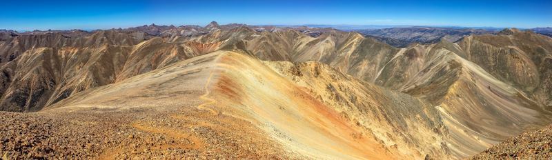
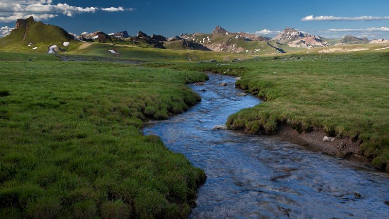
San Juan Mountains panorama, the range that forms the San Juan Skyway loop
Wikimedia / Mitchtobin (CC BY-SA 4.0)
The San Juan Skyway — Why It Deserves a Dedicated Trip

The San Juan Skyway passes through four distinct geological zones in one loop: the Colorado Plateau red rock country near Cortez, the volcanic San Juan Mountains, the caldera core around Silverton, and the glaciated terrain you've been driving through all day. It's one of the few drives in the country where the geology changes dramatically every 20 miles in ways that are visible from the road without needing a guidebook.
Telluride and Ouray together represent what Aspen and Vail might have become if the ski industry had arrived 50 years later. Both towns retain their mining-era bones: the Victorian commercial architecture, the narrow main streets, the proximity to real wilderness. Neither has been entirely homogenized by resort development. That window is narrowing.
Best season for the full loop
  • Late June through September: all roads open, wildflowers peaking, full accessibility
  • Mid-September through October: aspen color on Dallas Divide and the ridgelines near Telluride
  • January through March: ice climbing season in Ouray, winter wilderness for those equipped for it
  • May (now): the shoulder season. Snow still on the passes. Some trails closed. But dramatically fewer people and the first wildflowers.

📷 Photo Credits — All Images from Wikimedia Commons

glacial-cirque.jpg — Bureau of Land Management, Uncompahgre wilderness (Public domain)

million-dollar-highway.jpg — Dcoetzee, Uncompahgre Gorge · US-550 (CC BY-SA 4.0)

red-mountain-pass.jpg — Famartin, Red Mountain Pass (CC BY-SA 4.0)

box-canyon-falls.jpg — Mfield, Box Canyon Falls Ouray (CC BY-SA 3.0)

silverton-colorado.jpg — Famartin, Ouray Colorado Victorian commercial district (CC BY-SA 4.0)

glacier-lily.jpg — Walter Siegmund, Erythronium grandiflorum (CC BY-SA 3.0)

sky-pilot.jpg — Robb Hannawacker, NPS, Polemonium viscosum (Public domain)

indian-paintbrush.jpg — Stan Shebs, Castilleja chromosa (CC BY-SA 3.0)

pika-alpine.jpg — USFWS, Ochotona princeps (Public domain)

marmot-alpine.jpg — mtneer_man, Marmota flaviventris Rocky Mountain National Park (CC BY-SA 2.0)

san-juan-skyway.jpg — Mitchtobin, San Juan Mountains panorama (CC BY-SA 4.0)

u-shaped-valley.jpg — Ken Lund, Mt. Sneffels and Dallas Divide (CC BY-SA 2.0)

high-mountain-pass.jpg — Ken Lund, Ridgway Reservoir · San Juan Mountains (CC BY-SA 2.0)