🎧 Audio Companion · Day 4

The Railroad That Never Quit: Durango, the Animas River, and the San Juan Basin

Scroll along as you listen — photos and info cards match the audio order.
Colorado Hot Springs Road Trip · May 2026 · Elevation: 6,512 ft
DAY 4 · DURANGO
🎧 The Railroad That Never Quit — Durango & the Animas River

⬇️ Download episode MP3 (80 min · 74MB)
0:00 --:--
Speed:
🚂 Chapter 1: The Railroad That Never Quit
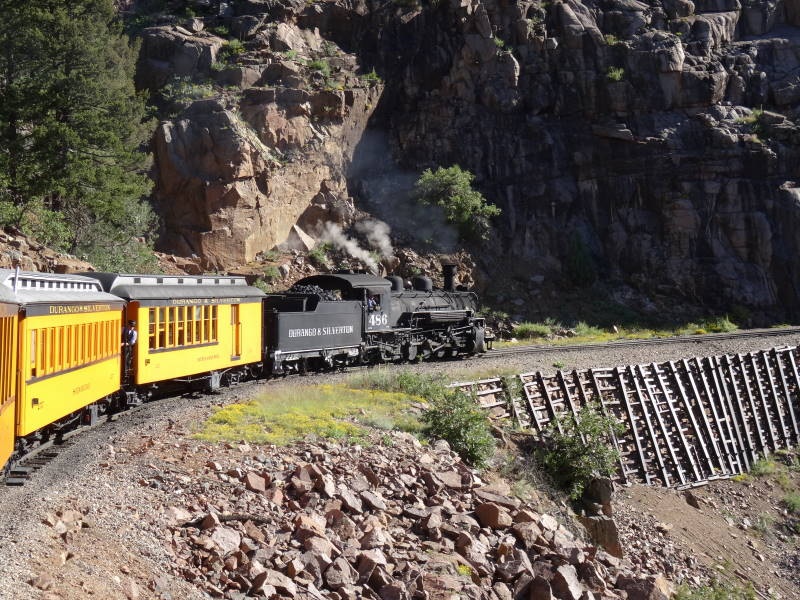
Durango and Silverton Narrow Gauge Railroad steam locomotive in Durango, Colorado
Wikimedia / Kbh3rd (CC BY-SA 3.0)
Operating since 1882
The Durango & Silverton Narrow Gauge Railroad

The railroad that simply kept going
There is no other railroad in the United States quite like this one. The Durango and Silverton Narrow Gauge Railroad has been running continuously since 1882. Not restored, not revived. Running. The same route. The same gauge of track. Coal-fired steam locomotives burning through the same canyon, climbing the same grade, crossing the same river bends that they have crossed for 144 years.
Built in nine months
Construction began in fall 1881 with approximately 500 workers pushing through winter terrain. The Animas gorge narrows to a slot in places, forces the track onto ledges above the river, and climbs grades that required the narrow 3-foot track specifically because standard gauge equipment would have been too wide for the curves and too heavy for the bridges. The grading crews reached Silverton in late spring of 1882. Total cost: $917,303 for 45.2 miles of line, completed in roughly nine months.
The 1923 K-28 locomotives
  • In 1923, the Denver and Rio Grande ordered ten new K-28 locomotives from the American Locomotive Works in Schenectady, New York
  • Known as "Sport Models" for their clean proportions and modern design for a narrow gauge machine
  • Locomotive 473, one of that 1923 batch, has been in continuous service on this line ever since
  • When you ride the D&SNG today, you may be sitting behind an engine manufactured over 100 years ago
What kept it alive
The Silver Panic of 1893 did not stop it. Two world wars did not stop it. The Great Depression did not stop it. What saved it in the late 1940s was Hollywood: filmmakers discovered the gorge, a series of Westerns brought national attention, and tourism took over where freight had left off. The American Society of Civil Engineers designated the line a National Historic Civil Engineering Landmark in 1968.
🏙️ Chapter 2: The City That Was Built on Purpose
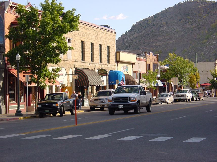
Durango, Colorado Main Avenue historic commercial district
Wikimedia / Kbh3rd (CC BY-SA 3.0)
Founded 1880
Durango — A Railroad Town Built to Order

Designed, not discovered
Most towns in the American West grew the way weeds grow: opportunistically. Durango is not that kind of town. In September 1880, General William Jackson Palmer, president of the Denver and Rio Grande Railroad, formed an entity called the Durango Trust and purchased land on the Animas River two miles south of the existing settlement of Animas City. The site was surveyed, platted, and lots went on sale at $50 to $100. In the first two days, buyers purchased more than $15,000 worth of parcels.
The smelter was the entire point
Palmer wanted a smelter town in the Animas Valley, close enough to the ore sources of the San Juans to receive material efficiently by rail but low enough in elevation to operate year-round. The smelter was built first. The railroad yards, workers' housing, commercial district, saloons and hotels, all of it existed in service of the industrial logic at the valley's center. The post office opened January 3, 1881. By April, the smelter was operational.
Growth by the numbers
  • Within one year of founding: population of 2,400
  • Within six years: the Durango smelter processed one million pounds of silver, lead, gold, and copper annually, employing 300 workers
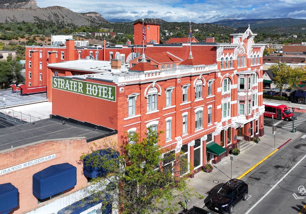
  • The Strater Hotel opened in 1887 as the Victorian showpiece of the planned city
  • Animas City, which had refused the railroad's terms, was eventually annexed by its more successful neighbor
  • The smelter operated until 1930; Durango reinvented itself around tourism, Fort Lewis College, and the narrow gauge railroad
The pretty downtown and the historic railroad are the legible surface of a story that goes considerably deeper: industrial planning, corporate real estate strategy, and a smelting operation that for five decades consumed the output of hard-rock mines employing thousands of workers.
🌎 Chapter 3: The Basin That Swallowed the Sea
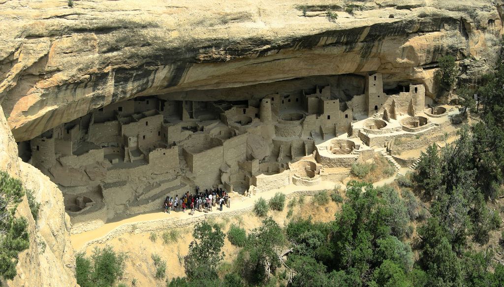
Cliff dwellings at Mesa Verde National Park, built into Cretaceous sandstone above the San Juan Basin
Wikimedia / Bogdan Giusca (CC BY-SA 3.0)
~75–80 million years ago
The San Juan Basin — Where the Cretaceous Sea Once Stood

The Western Interior Seaway
Where Durango sits today was the western shoreline of a shallow inland ocean called the Western Interior Seaway, roughly 60 to 100 feet deep, running from the Arctic to the Gulf of Mexico approximately 80 to 90 million years ago. Fine-grained marine muds accumulated on the seafloor and would eventually become the Mancos Shale, the thick gray formation visible in roadcuts throughout the Durango area. When you see it in a canyon wall, you are looking at compressed marine mud from a sea that no longer exists on this continent.
The coal swamps of the Fruitland Formation
As the Cretaceous period ended, the sea withdrew and a coastal plain environment took over: river deltas, swamps, and lowland forests under warm, humid conditions. The Fruitland Formation, which underlies much of the southern San Juan Basin, is one of the most productive coal-bearing geological units in North America, with an estimated 215 billion tons of coal. Those coal seams fueled the Durango smelter for half a century and powered the steam engines of the Denver and Rio Grande.
The mountains and basin as a paired system
  • As the San Juan Mountains rose, the crust adjacent to them flexed downward under their weight, creating a structural basin
  • The more the mountains rose, the more material they shed into the subsiding basin beside them
  • The volcanic San Juans and the sedimentary San Juan Basin are the same story told from opposite sides
  • Mesa Verde, 35 miles west of Durango, is the capstone of this sedimentary sequence: a thick resistant sandstone that protected softer shale from erosion, creating the alcoves where Ancestral Puebloans built cliff dwellings
🚗 Chapter 4: Reading the Walls on the Drive Down
What to Watch for on the Drive to Durango

The volcanic-to-sedimentary transition
The drive from Silverton to Durango on US-550 is a living geology lesson. As you drop in elevation, you are literally driving through time, from the young volcanic rocks of the San Juan caldera system into progressively older sedimentary formations that record the Cretaceous sea. Watch for the moment when the gray-brown shales start dominating the roadcuts, replacing the volcanic breccias and ignimbrites of the high country.
Landmarks to watch for
  • Purgatory/Durango Mountain Resort (25 miles north of Durango): marks the transition out of caldera country and into the montane zone
  • Animas Canyon narrowing: as you drop south, the canyon walls rise and close in; the river is cutting through older, harder rock
  • The first open valley view: south of the canyon, the Animas valley opens into the broader San Juan Basin landscape and Durango appears below you on the valley floor
  • Elevation change on this drive: from 9,318 ft in Silverton to 6,512 ft in Durango, nearly 3,000 feet of descent in 45 miles
What the vegetation tells you
Watch the treeline change as you descend: subalpine spruce-fir gives way to montane ponderosa pine on dry south-facing slopes, then transitions to pinon-juniper woodland as you approach Durango. Each vegetational zone is a direct expression of elevation, temperature, and moisture, and the zones are visible and distinct from the road.
🏹 Chapter 5: The Band That Stayed
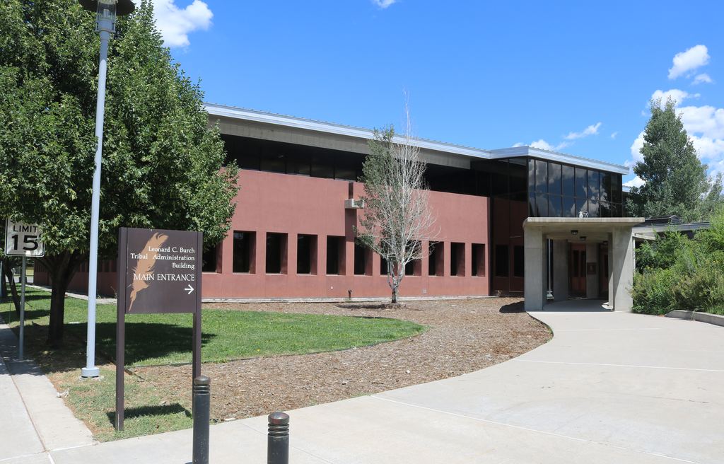
Southern Ute Indian Tribe tribal administration building, Ignacio, Colorado
Wikimedia / Famartin (CC BY-SA 4.0)
Reservation established 1895
The Southern Ute — The Band That Kept Its Land

A different outcome from the Uncompahgre removal
On Day 2, you heard the story of the Tabeguache Ute and their forced removal from the Uncompahgre Valley in 1881. The Southern Utes faced the same pressure. But when the commission overseeing removals reached the Southern Utes, a practical judgment was made: moving them would be more difficult and less politically necessary. They negotiated. Some of them stayed.
Three bands, one homeland
The Southern Utes are not a single band but a confederation of three: the Mouache, the Capote, and the Weeminuche. Their territory was the drainages feeding the San Juan River: the Animas, the La Plata, the Piedra, the Pine. The Animas River you have been traveling alongside since Silverton is a Southern Ute river. They called it Semca, "the river of lost souls," a name that may reflect its dangerous character in flood season.
What they retained
  • A 110-mile-long strip of land running east to west through La Plata, Archuleta, and Montezuma counties
  • Dramatically reduced from the 12-million-acre reservation, but in Colorado, along rivers they had names for
  • The Southern Ute Indian Tribe today: approximately 1,059 square miles, headquarters in Ignacio 25 miles southeast of Durango
The tribe today
The Southern Utes used natural gas and oil deposits in the San Juan Basin to build an economic base through the Southern Ute Growth Fund, established in the 1990s. They have litigated water rights on the Animas, negotiated mineral rights, built infrastructure, and maintained cultural programs. When you drive south of Durango, you are driving through sovereign Southern Ute territory. This is not a museum piece. It is a living nation.
🏛️ Chapter 6: From Fort to School to College
Strater Hotel in Durango, Colorado, built 1887, a Victorian landmark of the planned railroad city
Wikimedia / Famartin (CC BY-SA 4.0)
Fort 1880 → School 1891 → College 1956
Fort Lewis — Three Lives on the Same Ground

From military post to instrument of harm to institution of learning
About 15 miles west of Durango, on a mesa above Hesperus, stands what used to be a fort. Fort Lewis began in 1878 at Pagosa Springs and was moved to its current location in 1880. By 1891 the Army deemed it unnecessary and decommissioned it. The federal government did not abandon the site. It converted the former fort into an Indian boarding school.
The boarding school era
The philosophy guiding these schools was stated plainly by its own proponents: the goal was to "kill the Indian and save the man." Children were removed from their families, sometimes forcibly, prohibited from speaking their languages, required to wear Anglo clothing, given Anglo names, and punished for practicing traditional customs. Students from the Navajo, Ute, Sioux, and Apache nations attended Fort Lewis. Disease was common in the crowded dormitories. Fort Lewis College has publicly reckoned with this history and describes the process as an ongoing responsibility.
The 1911 mandate that still stands
In 1911, the federal government transferred the property to the state of Colorado with a legally binding condition: the institution must admit Native American students free of tuition, on an equal basis with all other students. That mandate has been in place for over a century. Fort Lewis College today enrolls students from more than 200 federally recognized tribal nations and has one of the highest percentages of Native American enrollment of any public college in the United States.
The stone buildings on the mesa
The old fort campus on the mesa above Hesperus, separate from the main Fort Lewis College in Durango, is on the National Register of Historic Places. The 19th-century stone buildings are well-maintained and worth a slow drive-through. They are beautiful, and they are also the physical remains of a chapter in American history that shaped generations of Native American families in this corner of Colorado.
♨️ Chapter 7: The Springs That Changed Their Name
Durango Hot Springs — Rebuilt and Renamed

A geothermal resource with a complicated history
Durango has had hot springs facilities on and off throughout its history, drawing on the geothermal resources of the broader San Juan region. The most recent incarnation is Durango Hot Springs, which rebuilt and reopened after a period of closure, with modern soaking pools and facilities designed for the contemporary wellness market.
What to know if you're planning a visit
  • Location: 6475 County Road 250, north of downtown Durango along the Animas River corridor
  • Multiple pools at varying temperatures, outdoor soaking in the Animas valley landscape
  • Unlike the city-owned pools at Ouray, this is a private commercial facility with reservation-based access
  • The Animas valley setting means the backdrop is river corridor and forested slopes, not dramatic alpine walls
Durango in the broader hot springs circuit
Durango sits at the southern end of a geothermal band running up through the San Juan Mountains. The springs at Ouray, Glenwood, and Pagosa Springs all tap variations of the same regional heat source. Pagosa Springs, 60 miles east on US-160, has the world's deepest known hot spring, the Mother Spring, and a developed facility on the San Juan River. If the route continues east, Pagosa is worth knowing about.
🌲 Chapter 8: The Tree That Smells Like Candy
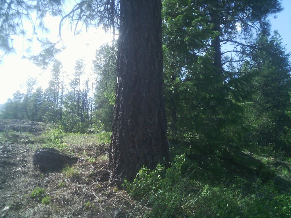
Ponderosa pine bark showing the orange-cinnamon plate pattern of a mature tree
Wikimedia / Walter Siegmund (CC BY-SA 3.0)
Ponderosa Pine — The Tree That Smells Like Vanilla
Pinus ponderosa

Do this when you stop
Find a ponderosa pine. Get out, walk to the tree, press your nose against the deeply furrowed plates of its bark on a warm afternoon, and breathe in. What you will smell is not what you expect from a tree: vanilla, or butterscotch. The ponderosa produces volatile terpene compounds in its bark that in warm conditions smell unmistakably of baked goods. The terpenes are a chemical defense against bark beetles, but their effect on human olfaction is a complete surprise.
The yellowbelly phase
Young ponderosas have dark, almost black bark. Older trees shed that outer layer to reveal bark the color of orange peel or pale cinnamon, broken into thick interlocking puzzle-piece plates. This transition, which typically happens around 110 years of age, is the "yellowbelly" phase. The new bark is where the terpene concentration is highest and the vanilla smell is strongest.
Fire ecology
  • Ponderosa forests evolved with frequent, low-intensity ground fire on a 5 to 10-year cycle
  • Mature ponderosa bark is up to six inches thick, an effective insulator against ground fire temperatures
  • Fire killed competing species, cleaned out accumulated fuel, and left the big trees standing
  • Fire suppression through the 20th century has created dense forests with accumulated fuel loads that now support catastrophic stand-replacing fires
What you're seeing around Durango
At Durango's elevation of 6,500 feet, ponderosa is the dominant tree on dry south-facing slopes. Below that, the forest transitions to pinon-juniper woodland. The mountain smells like a bakery.
🦌 Chapter 9: Wildlife of the Animas Corridor
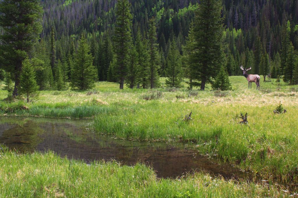
Bull Rocky Mountain elk in a meadow, antlers in velvet, Colorado
Wikimedia / NPS (Public domain)
Elk — The Dominant Ungulate of the San Juan Foothills
Cervus canadensis

What they're doing in late May
The San Juan elk herd is one of the largest in Colorado, which carries the largest elk population of any state with over 290,000 animals. The San Juan herd ranges from the Animas River east to Wolf Creek Pass and contains roughly 17,000 to 19,000 animals. In late May, the cows are calving in montane meadows and forest edges between 7,000 and 9,000 feet, the exact elevation band you are moving through. Calves are born spotted, nearly invisible when lying still in dappled light.
The bulls are in velvet
The bulls are at lower elevations right now. In late May, they are carrying velvet, the dense, blood-vessel-rich covering that grows the antlers from scratch every single year. Antlers are the fastest-growing tissue of any mammal, growing up to an inch per day in summer. If you see a bull with fuzzy, fat antler beams in a warm reddish tone, that is bone forming in real time.
Where to look
  • Scan edges of forest openings in early morning and late afternoon
  • Elk move to open terrain at dawn and dusk, retreat to forest cover midday
  • Meadows along the Animas north of Durango in the evening hours are reliable
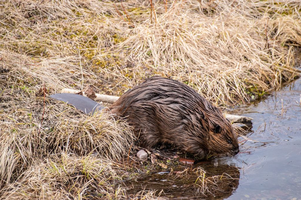
North American beaver (Castor canadensis) in riparian habitat
Wikimedia / Steve (CC BY 2.0)
American Beaver — The River Engineers
Castor canadensis

Disproportionate influence
Beavers are present in the Animas valley and have been recorded actively cutting cottonwoods in the wetland areas north of Durango. A single beaver dam raises the local water table, slows the water's movement, promotes sediment deposition, and creates the still-water conditions that cattails, sedges, and other wetland plants require. Research has found that beaver dams create hydraulic gradients in the streamside subsurface 10 to 13 times greater than seasonal flow variation.
Why beavers matter here
In Colorado's semi-arid landscape, narrow strips of river riparian forest support a disproportionate fraction of total biodiversity. Most amphibian species in the region, the majority of songbird species, many mammal species, and virtually all aquatic life depend on the riparian zone. Beaver activity has landscape-scale effects far beyond what you would expect from a 50-pound rodent.
Other wildlife in the corridor
  • Black bear: spring is the riskiest season; bears emerging from dens are in "walking hibernation" and progressively more hungry as May progresses. The Animas riparian forest is good year-round black bear habitat.
  • Cliff swallows: look for smooth, gray, gourd-shaped mud nests plastered against canyon walls in dense clusters. Each nest is constructed from 900 to 1,200 mud pellets, carried one at a time.
  • Pinon jay: obligate partner of the pinon pine; caches seeds in the ground, and unclaimed caches are how the pinon forest regenerates.
🌊 Chapter 10: What the River Remembers
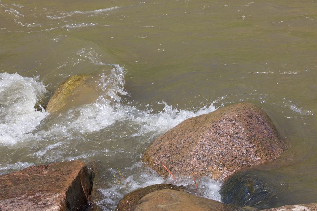
Animas River flowing through Durango, Colorado, with cottonwood riparian forest
Wikimedia / Jeffrey Beall (CC BY 4.0)
The Animas River and the Gold King Mine Spill

Several rivers in sequence
The Animas River is not the same river from bottom to top. It begins at about 12,000 feet in the peaks above Silverton, cold and fast and fed by snowmelt and seepage from old mine workings. By the time it reaches Durango at 6,500 feet, it has dropped more than a mile in elevation, more than doubled in volume from tributaries, warmed from near-freezing to something you could put your hand in, and passed through alpine, montane, and semi-arid riparian zones. The cottonwood-willow gallery forest along the Animas supports the majority of the region's songbird and amphibian diversity.
August 5, 2015 — the Gold King Mine spill
On that date, an EPA crew working at the Gold King Mine north of Silverton accidentally breached a plug of rock and soil holding back a reservoir of contaminated water inside the mine. The blowout released an estimated 3 million gallons of mine waste, carrying heavy metals including cadmium, lead, arsenic, beryllium, zinc, iron, and copper, directly into Cement Creek, a tributary of the Animas River. The contaminated water turned the Animas bright orange as it traveled downstream, reaching the Durango area within 24 hours.
  • Lead found at concentrations 100 times the allowable limit; iron at 326 times the limit
  • Durango halted its water intake from the Animas; river closed to all recreational use
  • The contaminated plume continued downstream into the San Juan River in New Mexico and reached Lake Powell
  • The most significant long-term impacts fell on the Navajo Nation, whose members depend on the San Juan River for agricultural irrigation
The sobering explanation for "rapid recovery"
Studies found the spill had little measurable long-term effect beyond what was already present, largely because the Animas already contained elevated heavy metal concentrations from 150 years of upstream mining. The Gold King spill was a dramatic, visible intensification of a chronic contamination problem accumulating since before the Durango smelter existed. In 2016, the EPA placed the Silverton mining district on the Superfund list. Remediation is expected to take decades and billions of dollars.
⏳ Chapter 11: Boarding the K-28 in 1923
The Strater Hotel in Durango, Colorado, built 1887, the Victorian centerpiece of the planned railroad city
Wikimedia / Carol Highsmith (Public domain)
1923
Boarding the K-28 in 1923 — The Duttons Could Have Been Here

The Durango of 1923
By 1923, Durango was 43 years old and had settled into its second identity. The frantic growth of the 1880s had stabilized. The smelter was still running, still processing ore that came down by rail from Silverton. The Victorian commercial buildings along Main Avenue were 30 years old. The Strater Hotel, which opened in 1887, had been hosting travelers for 36 years. The Diamond Belle Saloon had its ragtime piano. The town worked.
The railroad in 1923
That same year, the Denver and Rio Grande Western ordered the ten K-28 locomotives from the American Locomotive Works. The railroad was still a working enterprise, but the texture had changed. The great silver boom had peaked and receded. Mining continued at a reduced scale. The train was carrying a more complicated passenger mix: miners and merchants sharing coaches with tourists who had begun arriving specifically for the ride. The Animas gorge was already understood to be spectacular.
The 1923 connection to this trip
Locomotive 473, one of the K-28s ordered in 1923, has been in continuous service on this line ever since. When you board the D&SNG today, you may sit behind an engine that was running the year your great-grandparent may have been alive. The Strater Hotel is still operating. Main Avenue still has its Victorian bones. The scale of continuity is unusual in American towns. Almost nothing else from 1923 Durango is gone.
📍 Chapter 12: Come Back For This
Durango — What Requires a Return Trip

🏛️ Mesa Verde National Park
35 miles west on US-160. Over 52,000 acres, approximately 600 cliff dwellings including the largest in North America. Cliff Palace alone has 150 rooms and 23 kivas. Ranger-led tours required; book on recreation.gov weeks in advance. Minimum 5 hours for a meaningful visit, full day is better. Peak season: late May through October.
🏔 Weminuche Wilderness
488,000 acres, the largest wilderness area in Colorado. Access from Silverton by steam locomotive via D&SNG (Needleton and Elk Park stops). Colorado Trail and Continental Divide Trail segments through the Needle Mountains. June through September hiking season; early July for high routes after snowpack releases.
🚴 Animas River Whitewater
Class II through IV depending on stretch and season. Mild to Wild Rafting and Durango Rivertrippers run guided trips from the Durango put-in. Peak season: late May through July with snowmelt. For advanced kayakers, the Class IV Upper Animas from Silverton to Rockwood is a multi-day technical run.
🚂 D&SNG Full Round Trip
Approximately 9 hours Durango to Silverton and back, including the Silverton layover. Book at durangotrain.com, several weeks ahead for summer departures. The canyon section between Durango and Silverton is only accessible by train or on foot through the Weminuche. There is no practical way to fully experience this railroad from a car.
⛳️ Purgatory / Durango Mountain Resort
25 miles north on US-550. 1,600 acres of skiing across 11 lifts, vertical drop of 1,604 feet, ski season December through early April. In summer: lift-served mountain bike park with downhill trails and a beginner skills area. Day trip accessible from downtown Durango.
🍶 Ore House
147 E. College Dr. Colorado beef over mesquite, Durango institution since 1972. Wine list that takes itself seriously. Walking distance from downtown.
🍺 Steamworks Brewing
801 E. Second Ave. Converted industrial building, solid food, rotating beer selection leaning toward the hoppier end of the spectrum. Colorado IPAs and seasonals.
🏛️ The Strater Hotel
699 Main Ave, built 1887, still operating as a full-service historic hotel. The Diamond Belle Saloon ragtime piano bar runs most evenings. Continuously operating for nearly 140 years. Worth seeing even if you don't stay there.
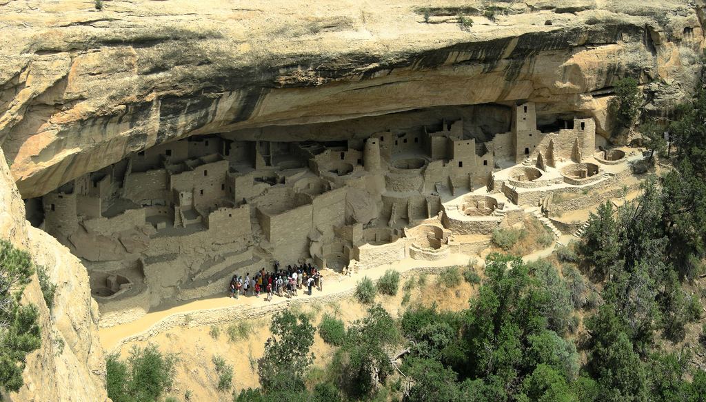
Cliff Palace at Mesa Verde National Park, 35 miles west of Durango, built into Cretaceous sandstone
Wikimedia / Bogdan Giusca (CC BY-SA 3.0)
Mesa Verde — Why the Geology Made It Possible

The cliff dwellings at Mesa Verde are not separate from the geology you have been hearing about all day. The Ancestral Puebloans built into alcoves carved into the Cliff House Sandstone, the same Cretaceous rock unit deposited along the shoreline of the Western Interior Seaway. The resistant sandstone cap protected the softer Mancos Shale below from erosion, creating the mesa profile. The alcoves formed where water percolated through the sandstone and eroded the shale layer below. Geology made the mesa. Geology made the alcoves. The people who found those alcoves recognized a sheltered, south-facing space with a reliable water seep. The deep human history here is inseparable from the deep geological history.
Durango rewards time. A dedicated return, with the D&SNG round trip, a full day at Mesa Verde, and an evening at the Strater, would be a very good few days in southwestern Colorado.

📷 Photo Credits — All Images from Wikimedia Commons

dsng-locomotive.jpg — Kbh3rd, Durango and Silverton Narrow Gauge Railroad locomotive (CC BY-SA 3.0)

durango-main-avenue.jpg — Kbh3rd, Durango Colorado Main Avenue (CC BY-SA 3.0)

san-juan-basin.jpg — Bogdan Giusca, Mesa Verde National Park cliff dwellings (CC BY-SA 3.0)

southern-ute.jpg — Famartin, Southern Ute Tribal Administration Building, Ignacio, Colorado (CC BY-SA 4.0)

strater-hotel.jpg — Famartin, Strater Hotel, Durango, Colorado (CC BY-SA 4.0)

ponderosa-pine-bark.jpg — Walter Siegmund, Pinus ponderosa bark (CC BY-SA 3.0)

elk-bull.jpg — NPS, Rocky Mountain bull elk in meadow (Public domain)

american-beaver.jpg — Steve, North American beaver Castor canadensis (CC BY 2.0)

animas-river.jpg — Jeffrey Beall, Animas River in Durango, Colorado (CC BY 4.0)

mesa-verde-cliff.jpg — Bogdan Giusca, Cliff Palace, Mesa Verde National Park (CC BY-SA 3.0)